Showing posts with label bus. Show all posts

Wednesday, July 14, 2021

TRANSIT REPORT: San Francisco, California


(Note: Fares updated July, 2021 and face masks are required on all public transit - Ed)

San Francisco is California’s most transit oriented city. It’s the nerve center of Northern California and many regional transportation systems converge here. The city itself is served mainly by Muni (San Francisco Municipal Railroad) and BART (Bay Area Rapid Transit) with robust commuter rail service provided by CalTrain. Regional operators Golden Gate Transit and AC Transit also provide bus service into the city from points beyond. A number of ferry operators also provide commuter service across the bay into San Francisco proper. More than a dozen different operators and agencies also provide bus and rail service outside of the city to points around the bay.

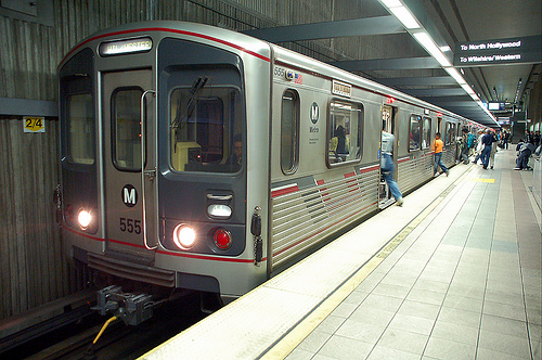
MUNI - The city’s main transit provider runs a system of buses, trolleys, and cable cars.

Picture courtesy of Wikimedia
Steve Morgan under CC-BY-SA license

BUSES – Buses run just about everywhere in the city and it seems like you’re never more than a block or two from a line. There are regular fuel powered buses along with overhead wire electrified trolley buses. All vehicles in the MUNI bus fleet are now accessible. Click the following link for a route map.

Bus fares are $3, $1.25 for disabled and seniors. Transfers are free and can be used for two more trip, including returning to your original destination as long as you do it before it expires (120 minutes from original issue).

TROLLEYS – The trolley system here (not to be confused with the cable cars) runs down Market Street underground and to points beyond above ground. Historic trolleys…using restored antique trolley cars from around the world…run above ground on Market Street continuing on to Fisherman’s Wharf. All stations along Market Street are wheelchair accessible, both above and below ground. The historic streetcars are mostly accessible and stops either have ramps or embedded lifts that will raise your wheelchair up to door level when the car approaches. The T line is completely accessible, the J, K, L, M, and N lines are wheelchair accessible at designated stops only. See this link for a list and compare with this route map to see if your destination is served. If it can’t be done by trolley, chances are you can do it via the bus system.

Trolley fares are the same as the bus fares.

CABLE CARS – These are rolling historical landmarks and are not wheelchair accessible. If you do want to ride one, you’ll need to leave your chair behind. If you can walk a little bit, you can probably board. The cost is $8.

Visitors can purchase 1, 3, and 7 day passes that are good for unlimited rides on the entire system, including cable cars. The costs are $24, $36, and $46 respectively and are sold at various outlets throughout the city and the airport. Click the link to find sales locations.


Photo courtesy of Wikimedia
Jon 'ShakataGaNai' Davis under CC-BY-SA license

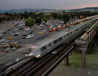
BART is a heavy-rail system that works as commuter rail from points in the East Bay and the airport. It runs as a subway under Market Street. All lines converge here from Millbrae and the airport in the south and Fremont, Dublin/Pleasanton, Pittsburgh, and Richmond in the East Bay. The complete system and all stations are wheelchair accessible. Fares are distance based and vary, you can check this calculator to see how much your ride will cost. All BART fares are now paid via a Clipper Card, a one-time fee of $3 is required to buy one.

One word of concern about MUNI and BART – our experience with several of their station employees and drivers were the worst encounters we’ve ever had from transit employees that included being yelled at for a) asking a question, b) going the wrong way, and c) not knowing the name of the stop we wanted to get off at. Be prepared, they may get you where you’re going but not always with a smile.

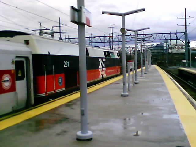
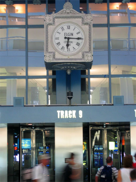
CALTRAIN is a commuter rail line that runs along the West Bay peninsula from San Jose, and Gilroy just a little bit, to the San Francisco station just a few blocks south of Market Street. There are stations along the way in places like Santa Clara, Sunnyvale, Palo Alto, Mountain View, Redwood City, San Mateo, and South San Francisco. The passenger cars are double-deckers with wheelchairs riding on the bottom level. Each station has a wheelchair ramp built into the platform, chair users should wait on top to board the train…the conductor will deploy a ramp to get you in. Fares are distance based from a low of $3.75 one-way for one zone to a high of $15 for six zones. A day pass is available for twice the amount of a one-way ticket, disabled and senior riders pay a little less than half price.

FERRIES are operated by several companies and cruise into the city from Alameda, Oakland, Vallejo, Tiburon, and Sausalito. Fares start at $5.75 and disabled fares start at $2.75. All are wheelchair accessible.

AC Transit runs buses from Oakland and the East Bay and Golden Gate Transit from Marin County. All buses are wheelchair accessible.

A multitude of agencies run buses, trains, and ferries to other parts of the bay area that don’t come into San Francisco. For complete information about these agencies, plus the ferries and commuter buses, go to transit.511.org for complete transit information for the area.

San Francisco is one of the world’s premiere travel destinations and is very easy to see in a wheelchair. Have fun.


-Darryl
Copyright 2010 – Darryl Musick

Wednesday, August 29, 2018

ADVENTURES CLOSE TO HOME: The Commute


(NOTE: The busiest bus station west of the Mississippi is in my hometown of El Monte. It turns 45 years old this year. When first opened, back in 1973, it seemed so futuristic, with the buses pulling into it's 6 berths and the dispatcher announcing the buses and destinations.  With the advent of newer, longer buses, the station grew outdated and the whole thing was demolished. A new, replacement station opened in 2012. 

This is a 'day in the life' of commuting from that station from 2015. Since that time, two things have happened...I switched my work commute to the Gold Line light rail train in 2016 and then retired completely earlier this year.  

Other than the now $2 a day charged for parking, I'm sure the following is still pretty true...)

It's ten minutes, more or less, from my front door to the bus station. Only a few slowpokes that are easily passed. Don't see the guy in the Fiero who goes 50 mph and heads straight for the fast lane and there are just a few of the double gravel haulers that tend to clog up the 605 as they bring their loads out of the quarries of Azusa and Irwindale.  A sea of red lights up ahead just past the Santa Anita exit on the 10 but the bus station is at that exit so I avoid that mess.

Construction takes a chunk out of the parking lot. Luckily I start very early so I don't get shut out of the musical chairs of the late parking lot. Up on the upper level of the station, more construction awaits, taking away half of the upper deck.


The tamale cart is setting up like it always does at this time of day. I'm always too early to take advantage of that $1.50 breakfast. In the afternoon when I come home, they're taking it down.

It's a cloudy day as I enter the almost new station.  For the first time in a week, the escalators are working so I hop down to the bottom.


During construction, my bus...the 481...has been relocated downstairs.  Of course, if I make it ontime, the 6:20 bus is nowhere to be seen. Either it left early (judging by the lack of line, this is my guess) or the driver called in sick on a Monday again after a grueling weekend.


6:23 and still no bus in sight, I hustle upstairs to catch the Silver Line, which I can take to another stop one block farther from my usual one. It's also packed to the gills.


Luckily, I get one of the last seats, squeezed in by my seatmate like a bad economy section on a plane. They're all here this morning...the lady talking to herself; the gentleman with hygiene issues; the gang banger with the prison tattoo peeking over his collar...but we're in luck this morning because none of the usual suspects makes any problems.


It's no fun being squeezed into this standing-room-only bus but those Metro drivers and their lead feet make it just a 10 minute ride to the other end of the busway and my stop.


Not so bad this morning but the things I have seen on rides...the guy in the far back corner sipping on his tall boy Budweiser thinking no one notices, the other guy on a well air conditioned bus opening all the windows yelling that he's being poisoned (and hitting anyone that wants to stop him), the hygienically challenged, the guy who has to do an exercise routine the whole ride, the seatmate who thinks they can just lean on you and take a nap, seeing a bus overturned, the just released jail inmates who talk their way onto the bus without any fare, the sniffly sneezy coughy person sitting next to you...the list goes one. It can be entertaining but, mostly, it's just annoying. Rarely, it can be dangerous.


I make it to my stop, navigate around the homeless and the trash and walk the two blocks to work.


The afternoon finds me taking the Silver Streak home. This is not to be confused with the Silver Line. The former is run by Foothill Transit, the latter is Metro. Newbies often show up at the bus stop, a bewildered look on their face..."Do I take the Silver Line or the Silver Streak?"...but with time, they're able to tell the difference (the Silver Streak runs from Montclair on the San Bernardino County border to downtown L.A. while the Silver Line runs from El Monte to Torrance. Both go via El Monte and the San Bernardino busway so the mid portions of their runs are almost identical).


It's almost empty, a nice sight at the end of a long day but...what's this?...a jailbird pleading with the driver to get on with no money. Of course, the driver lets him. They always let them and wonder what went wrong when they start causing problems.

Today, he wanders to the back of the bus and starts talking loudly and obscenely to himself but, other than that, doesn't cause any more problems. At least until El Monte, where I get off the bus and drive home.

All in all, thankful for a relatively peaceful commute. I'll pick it up again in the morning and cross my fingers that it goes well again.

Darryl
Copyright 2015 - Darryl Musick
All Rights Reserved


Wednesday, January 3, 2018

TRANSIT REPORT - Los Angeles 2018


There's been some big moves in Los Angeles public transit since we last took a look.  See the updates below, in red.

UPDATE: January 2018

Does Los Angeles now have the most extensive, wheelchair accessible rail system in the USA? Let's do a little comparison (stats below do not include inter-urban commuter rail)...

New York has 651 miles of rail transit with 96 accessible stations out of 425, or a little less than 1 out of every 4.

Boston has 78 miles of rail transit with 97 accessible stations out of 133, or about 3 out of every 4.

Chicago has 102 miles of rail transit with 99 stations out of 148, or about 2 out of every 3.

Los Angeles has 105 miles of rail transit with 93 stations, all accessible. Plus, there is another rapid bus line that runs just like rail transit on it's own right of way for 18 miles with 29 accessible stations.

Maybe New York can make the claim but, otherwise, it sure looks like L.A. has the most extensive, accessible system.

Since our last update, the Expo Line has opened up connecting downtown Los Angeles with the beach at Santa Monica. This is the second line that has connected to an oceanfront area as the Blue Line connects to Long Beach. Soon, the Crenshaw Line will open up, making a connection between the Expo and Green Lines, with a connection to a new people mover to Los Angeles International Airport finally making rail service into LAX a reality and construction just started on another 12 mile extension to the Gold Line that will take it to the edge of San Bernardino County in Montclair.

Angels Flight is back in service with a dollar fare (50 cents for TAP card holders).

UPDATED: March 2016 - see red section, below.


Watch the Video!


Just a touch over six years ago, we wrote the following on the last day of operation for the old El Monte bus station:

This week marked the end of the original El Monte Bus Station.  Built in 1973 and looking like a flying saucer, it was the first modern public transit structure to be built since the end of the trolley days here in Southern California.  It anchored the El Monte - Los Angeles busway...a dedicated lane for buses along Interstate 10.  Riders came here and used it much like a subway station to catch express buses into Los Angeles, bypassing the traffic jams on the San Bernardino Freeway.

The station is set to be demolished and replaced with a new station, opening next year.

(See photo of the new station, below)


The station is round and has its own roadway onto the busway.  Riders entered from below and used stairs, an escalator, or an elevator to get to the upper level.  Originally, there were 10 berth were buses could pickup and discharge passengers.  This was later reduced to 8 when Foothill Transit started the Silver Streak line, using longer articulated buses that needed longer platforms.  The final nail in the coffin was Metro's introduction of the Silver Line, which also used buses that were longer than the platform.


The upper level consisted mainly of walkways that increasingly got crowded.  The lower level had a big plaza that was pretty much unused.  


Greyhound had a ticket office on the lonely lower level.


September 12, 2010, marked the last day of operations here.  One of the last Silver Line buses awaits departure.


UPDATE: Sunday, October 14, 2012, marked the debut of the new El Monte Bus Station. Certified LEED for energy efficiency, the new station loads buses on two levels and increases daily passenger capacity from 22,000 to 40,000...now they need to work on getting parking space for those 40,000 passengers. 

The station is the main point for Silver express service to downtown Los Angeles and beyond.  New is the fare sharing for both of the Silvers...Foothill Transit's Silver Streak and Metro's Silver Line will both use the same fare, $2.45. Either lines passes will also be honored on the other. 

Note for handicapped passengers: Foothill does not have disabled discounts during rush hours...use the Silver Line instead if you want to use a discount.


If you’re in a wheelchair, and heading to Los Angeles, your transit options got a big boost last fall. The Silver Line express bus service incorporates accessible buses that travel, for the most part, on their own dedicated roadways along the center of the 10 and 110 freeways, from the El Monte Station to Torrance. The line leaves the busways in downtown Los Angeles for several local street stops including Union Station (home to several rail lines), 7th Street Station (start of the LA-Long Beach Blue Line light rail), Staples Center, Disney Hall, Grand Central Market, and more. Full fare is $2.45. Disabled discounts are available but Metro has been criticized lately for ignoring disabled passengers needs, such as securing wheelchairs with tie-downs.


MARCH 15, 2010 UPDATE:  L.A.'s oldest public transportation, Angel's Flight, resumed service on March 15, 2010.  It was originally built in 1901, the little orange funicular tranported residents of Bunker Hill down to the shops of Downtown Los Angeles.  It was removed in 1969 when Bunker Hill was redeveloped into high-rise office buildings and put in storage.  It opened again in 1996 just south of the original site, at the back entrance to the Grand Central Market and now connects the market to the Water Court on top of Bunker Hill.  A fatal accident closed it again in 2001.  Since then, reconstruction has replaced what was faulty back then and 9 years later, here we are again.  One car is accessible.  Cost is a quarter each way.

March 2014 UPDATE: Again, Angel's Flight is down. one car derailed last fall and extremely shoddy maintenance and operation practices were revealed, including staff taking a branch from a nearby tree and disabling the emergency stop with it. Repairs have been made and the funicular is in testing mode now but not currently open.
The similarly named and routed Silver Streak runs basically the same route from the El Monte Station to downtown where it terminates. However, the Silver Streak…run not by Metro but by Foothill Transit instead…starts in Montclair, about 30 miles east of El Monte. The Silver Streak uses 60 passenger articulating, low-floor buses with two wheelchair anchor points on each coach. Foothill is usually a little nicer with cleaner coaches and less crowding. Full fare is $2.50 and no disabled discounts are given during rush hours.


In November, the Gold Line light rail line was extended from Union Station to the eastern edge of East LA. You now have a one-ride option from the east side of Pasadena through to East LA. Several nice areas can be accessed through this line…Old Town Pasadena, Pasadena City College, South Pasadena, downtown Highland Park, Chinatown, Union Station (with Olvera Street and Phillipe’s adjacent), Little Tokyo, Mariachi Plaza, and the many fine Mexican restaurants of East LA.


The Expo Line is now open on its first segment from downtown to Culver City, going by USC and Exposition Park along the way. The next phase of the Gold Line, extending it from Pasadena to Azusa, broke ground in June (personal note, back when Tim was on the radio he got to interview the CEO of the Gold Line Foothill extension who was none to pleased with the MTA's foot-dragging in building this line).

The Gold Line Extension is now open, going east to Glendora at Citrus College with stations in Arcadia, Monrovia, Duarte, Irwindale, and Azusa in between.

On May 20, the Expo Line will open its next segment terminating at Santa Monica Pier (the western terminus of Route 66) marking the first light rail or subway line to reach the beach in the modern era.


These join the existing Red Line subway… going from Union Station to North Hollywood via Hollywood and Universal Studios, the Purple Line subway…Union Station to Wilshire Bl. and Western Ave. (home of the Wiltern Theater), the Blue Line light rail…from downtown to Long Beach, the Orange Line busway…running from Woodland Hills to the North Hollywood Red Line terminus (note: the Orange Line has been extended to Chatsworth), and the Green Line light rail running from Norwalk to Redondo Beach via the median of the 105 freeway.

Metrolink also runs several commuter rail lines converging on Union Station from San Bernardino, Oxnard, Oceanside, Riverside, and Palmdale.  Metrolink has had its issues too, but in general, they are very accessible and responsive to wheelchair needs.


All of Los Angeles' rail lines, stations, and bus lines are wheelchair accessible.

Next time you visit, try some of the areas transportation options.  LA’s still not a transit paradise but we’re taking baby steps out of the car and onto the rails. 


Darryl

Copyright 2009 - Darryl Musick
Pictures courtesy of Wikimedia Commons
The Port of Authority
Alossic under CC-BY license
Foothill Transit under CC-SA license
Justin N under CC-SA license


Wednesday, May 10, 2017

TRAVEL TIPS - Local Transit


There are two ways to really get to know the locals when you go on a trip.  One is to visit local restaurants and, especially, pubs or taverns.  The other is to use the local mass transit.  This lets you really see how locals live and gets you a taste of their everyday lives.

Tim and I both are big boosters of public transit, both here in L.A. and beyond.  On vacation, locations with good mass transit offer you (usually) an accessible way to get around quickly; a cheap mode of transportation; local culture immersion; and a safe way to get home after a late night at the pub.

This is the main reason you see our Transit Reports here.

Rental cars are expensive...wheelchair vans are ungodly expensive, so we like to do without as much as we can.  Taxis are also expensive and accessible cabs usually are hard to find.  There are a few exceptions, London springs to mind as an easy place to get an accessible taxi but they are still expensive.

Some great destinations that have good, accessile transit include New York, San Francisco, Seattle, London, Boston, and Munich.  Many more locations have at least adequate transit, like here in Los Angeles.

If it's possible, we recommend that you use the public transit option as much as possible.  It has really enhanced our travel experiences when we do it.  Below are some examples:

London Step-free Underground Map (PDF)

New York Subway Map (Look for wheelchair icon next to station name)

San Fransisco Transit Map (PDF - Look for wheelchair icons)

Boston T Map (Look for wheelchair icons)

Munich Barrier-Free U-Bahn and S-Bahn Map (PDF)

-Darryl

Tuesday, February 24, 2015

ADVENTURES CLOSE TO HOME: The L.A. Transit Parallax


It's hard to believe but recently Los Angeles was ranked as the 3rd most transit friendly city in the United States.  We've made huge strides here in this sun-soaked metropolis in public transportation in the last two decades and there's more to come.

We now have a subway, several light rail lines, and commuter rail to go along with our vast bus system.  The one thing we don't have (yet) are signs at the stops and most stations telling you when the next ride will be coming like they do in Europe.

There are some transit apps for your smart phone or tablet that can be utilized to various effectiveness.  We're going to put the top three to the test...NEXTRIP, NEXTBUS, and the LADOT App.


NEXTRIP is used by Foothill Transit to predict when the next Foothill Transit bus will arrive at your stop.  It's not too hard to use. You go to the site, www.foothilltransit.org/NEXTRIP ; find the bus line you're waiting for; and use the dial bar at the bottom to dial in your stop. When you press "Done" the next three predicted bus arrivals appear.


My Foothill Transit bus is only a minute late

NEXTRIP uses GPS technology that pairs the bus location to the stop chosen.

PROS: From the three or four tests I've done with it, it's pretty accurate. Bus arrivals were within a minute of what is displayed.

CONS: There's no reload button. You have to start at the beginning to recalculate or choose another bus stop.  It only displays Foothill Transit buses when there might be a number of buses using the same stop from other transit agencies.


NEXTBUS is an independent arrival app technology. It's at nextbus.com . Nextbus uses the GPS location of your phone to predict when the next bus, or train, will arrive. It has the advantage of redirecting you to another stop or station nearby if that is a better choice.

PROS: Nextbus will give you a menu of several providers that come by your area, you're not limited to one.  It uses the GPS location of your smart device, thus enabling it to display numerous stops or stations in your area which you can use to determine the most efficient bus line or train to take to your destination, not necessarily the one that will stop at the stop you're standing at.

CONS: Is supposed to be accurate to 2000 meters...that's two kilometers...and prediction times are not as accurate as the other two apps listed here.


LADOT App is provided by the L.A. Department of Transportation and provides arrival predictions of its buses, most notably the DASH buses used downtown. It has the added feature of having a live map showing you icons of exactly where the buses are at any given moment. Get it at ladotbus.com.

PROS: The maps are very accurate and the bus icons shown on them are a perfect way to see exactly where that bus is.

CONS: Only works with LADOT buses. Sometimes the GPS units in the buses are not working so those buses do not show up on the map.

While I think the LADOT app works the best, the Foothill app is also pretty accurate, while the NEXTBUS app is not quite as accurate but covers more transit providers.

Next time you're waiting for the bus in L.A., be sure to have each of these bookmarked so you know when your ride will be there.

Darryl
Copyright 2015-Darryl Musick
All Rights Reserved

Wednesday, November 14, 2012

TRANSIT REPORT: Denver, Colorado


Denver is a very large city surrounded by a patchwork of smaller towns, plains, and mountains.  It's transit system is actively growing and is not quite a mature system.  Some things work quite well, others are OK, and there are still patches where transit is not yet a viable option.

Public transit here is provided by the Denver Regional Transportation District (RTD) and is a mix of light rail and buses.


LIGHT RAIL - Currently, there are five lines that make up the light rail system.  It runs two lines to the south to Englewood and Littleton and terminates at two points to the north of downtown, 30th and Downing and Union Station at the western end of the 16th Street Mall.

Inside, the trains are clean, modern, and fast. For wheelchair users, there is a raised platform at the end of each station at the driver's end.  A manual ramp is deployed by the driver to allow chairs and strollers to board.  In this configuration, up to three wheelchairs or strollers can be on any given train.  The trains themselves have a much larger capacity.  Either 12 or 18 chairs/strollers can be on a train (depending on if it is a 2 or 3 car train) and if the platforms were built to train level instead of below it, more chair users could be accomodated. 

New lines under construction are also following the lower platform model the current stations have.

Chair users must tell the driver where they plan on exiting so the ramp can be deployed.  This seems like a missed opportunity in universal design and puts an extra burden on wheelchair users that the general public does not have.

Another egregious lapse in the system is that it does not serve the airport but a line is under construction and service to the airport is expected to begin in 2016. To the west, a new line to Golden that will get you close...but not quite...to the Coors brewery will open in 2013.

BUSES - The buses run by the RTD are like most cities in the U.S.  A lift or ramp is deployed from the front door and up to two wheelchairs can be accomodated in each bus.  Tie-downs are installed in each position.

The bus system covers a much larger area reaching towns in the nearby Rockies to the west; Boulder to the north; Denver International Aiport to the east, and the county line to the south.

16th STREET MALL FREE SHUTTLE - One of the stars of the transit system here is the shuttle that moves people back and forth along the mile long 16th Street Mall from Union Station on the west end to the Capitol Building on the east end.  Just about anything you want to do in downtown is within 3 blocks of this route.

The buses are electric/hybrids and have multiple entry doors like trains.  Wheelchairs enter via the second door where the driver can deploy a manual ramp.  It's an easy entrance into the two wheelchair locations and tie-downs are available.  Buses run every couple of minutes and are among the easiest I've seen for wheelchair entrance and exit.  They are also free.

SKYRIDE - RTD also operates a bus service to the airport via large buses that serve Englewood to the south, downtown, Broomfield to the north, and Lakewood to the west.  It also connects with several light rail stations.  Fares run $9, $11, or $13 each way.

Unless noted above, the basic fare on buses or light rail is $2.25 (disabled $1.10), which is in the high range for most transit systems. 

Day and multi-day passes are also available, which would make it a little more affordable for travelers, except that they're not available at the stations...you have to buy them at approved retailers such as Safeway.  This makes it pretty hard for a traveler to get one when they're in town.


-Darryl
Copyright 2011 - Darryl Musick
All Rights Reserved
Front Range Express provides accessible bus service between Denver and Colorado Springs for $11 each way.

Wednesday, October 31, 2012

TRANSIT REPORT - NEW YORK CITY


UPDATE: For service status following Hurricane Sandy, check this page: MTA Service Advisory

New York is a dizzying, confusing place but, if you do your homework, you can navigate your way through the city in a wheelchair.  Here are your major options.


AIRPORT TRANSPORTATION - The two major New York airports are Kennedy and La Guardia.  Amazingly in this city of subways, neither is connected to that system.  Your best bet is to either request an accessible taxi at the taxi stand, or to book an accessible shuttle from a company such as Supershuttle.  If you're more adventurous, and don't have a lot of luggage, you can catch an MTA bus.  At La Guardia, it's not too far to take the 48 bus to Queen's and catch the 7 subway there into the city at the accessible Flushing-Main St. station.  At Kennedy, you can take the AirTrain to the accessible Sutphin subway station (E line) or to the accessible Howard Beach subway station (A line).  We did try the bus option from La Guardia.   It's doable, but coming back it's very confusing finding the right bus stop when you get off of the subway.  We haven't tried the Kennedy option yet.  There is also train service from Newark airport and nearby the Islip airport, which you'd either have to taxi or bus to...it would be about a mile walk from the airport to the train station.  We did this via a taxi one time...if possible, I'd rather fly into one of the other three airports.


SUBWAY - Let's face it, it's just not New York without the subway.  When possible, it's also the fastest way to get around.  There are currently 33 accessible subway stations in Manhattan listed on the MTA's website.  Some popular locations with accessible stations are Times Square, Herald Square, Penn Station, Grand Central Station, Brooklyn Bridge, Rockefeller Center, Roosevelt Island, and the World Trade Center station.  Outside of Manhattan you have Yankee Stadium, Coney Island, and Flushing Meadows Park.  There are several more non-accessible stations where you can transfer between lines in a wheelchair.  It is very important to study the map and information provided by the MTA's website for particular access information, for example some lines may be accessible in a station while others in the same station are not such as Times Square, where the shuttle (S) is not accessible.

The basic fare for buses or subways is $2.50. A 7-Day pass is $29. (2012)


BUS - All buses in New York are accessible.  We had no problems on any bus or with any drivers while we were there.  The only problem is that they must also sit in traffic, although they have dedicated lanes on the busiest streets.


STATEN ISLAND FERRY - is accessible and a great way to get good views of the city and the Statue of Liberty. The Staten Island Ferry is free.

STATUE OF LIBERTY/ELLIS ISLAND FERRY - is accessible.


ROOSEVELT ISLAND TRAMWAY - is accessible.


TAXIS - Most are not accessible.  You'll usually need to call a dispatcher to have one sent, it is very hard to hail an accessible cab on the street.


LONG ISLAND RAILROAD - In Manhattan, the LIRR uses the accessible Penn Station, underneath Madison Square Garden.  Click the link for a map of accessible stations.


METRO NORTH RAILROAD - For points upstate and Connecticut, the Metro North uses Grand Central Station, which is accessible.  For points across the Hudson, Metro North uses Penn Station, which is also accessible.  Click the link for a map of accessible stations.

-Darryl
Photos courtesy of Wikimedia Commons
Diliff and Janke under CC-BY license
Daniel Schwen under CC-BY-SA license
Kris Arnold under CC-BY-SA license

Wednesday, October 24, 2012

TRANSIT REPORT - CHICAGO 2010

Picture courtesy of Wikimedia
Rob Pongsajapan under CC-BY license

The main transit agency in Chicago is the Chicago Transit Authority (CTA). They run a system of buses and subway trains. Most of the trains run above ground, much of that on elevated tracks so the system is known locally as the "L" (for elevated).
Picture courtesy of Wikimedia
Kelly Martin under CC-BY-SA license
BUSES

Chicago was a bit late to the accessible bus party, but now 100% of their fleets and routes are wheelchair accessible. I remember when we were there in 2001, we were at a bus stop and a bus with a wheelchair lift stopped but because it was not designated as a wheelchair accessible route, the driver would not pick us up.  The new policy opens up vast swaths of the city that were not available to wheelers before.

Buses go just about everywhere here and come by often. You’re never more than a couple of blocks away from a bus line. Normal fare is $2.25 (2012) and a day pass can be had for $5.75. Disabled riders can board for a dollar. An RTA reduced fare is technically required, but in our experience, if you’re obviously disabled, you can ride for this fare.

Illinois residents with disabilities can apply to the RTA for a free ride card.

Picture courtesy of Wikimedia
JeremyA under CC-BY-SA license

THE L


The L serves much of the main corridors of the city. We found we could get to about 90% of the places we wanted to go via accessible L service. First, both airports…O’Hare and Midway…have accessible L stations. The Blue Line serves O’Hare and the Orange Line serves Midway.

Both ballparks are served by the Red Line with Wrigley Field next to the Addison station north of downtown (north side) and US Cellular Field (Comiskey Park) served by the 35th Street station. Each station is less than a block from their respective stadiums.

Soldier Field is served by the accessible Roosevelt Station on the Orange, Green and Red Lines.

The Loop is the downtown area where several L lines go in a circle around the area on elevated tracks…the Blue and Red line go through this area underground. The Pink and Orange lines go in a clockwise direction while the Brown line goes in a counter-clockwise direction. 7 of the 14 Loop stations are accessible.

Chicago can get extremely cold. Each L station has an area where you can press a button and a space heater will run for 15 minutes to keep you warm while you wait for the train.

Fares are the same as for the buses (above).

Click on the link for a route map for the CTA. Wheelchair accessible L stations have the wheelchair symbol next to them.

METRA


METRA is a commuter rail service providing service between Chicago and the suburbs to the North, West, and South. All downtown METRA stations are accessible. You can view a map and get a list of their accessible stations at their website, http://www.metrarail.com/ . It keeps crashing my browser but maybe you’ll have better luck.

One way, full fare tickets run from $2.75 to $9.25 (2012). People with disabilities pay a little less than half price. On weekends, up to 3 children…age 11 and under…can ride free with each paying adult. Adults can get a weekend pass for $7 good for both Saturday and Sunday.

PACE

PACE is a regional bus service that serves Cook, Lake, Will, Kane, McHenry, and DuPage counties. It also serves nearby cities in Indiana. All PACE buses are accessible but their website is in dire need of a makeover. Fares runs from $1.75 to $4.00 (2010) with disabled fares running from 85 cents to $2.00.

-Darryl