
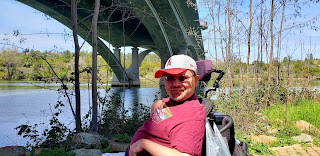
Back when we were based in the Los Angeles area, we came up with a list of Southern California's Top Wheelchair hiking trails. Now that we live in the northern half of the state, we figure it's time to start another list up here. We're also lucky that Tim is finally starting to show an interest in the world outdoors so we're able to attack it a little better now than we were back in L.A.
This will be an ongoing list, with additions as we find and experience them. Here is our list of the best wheelchair accessible hiking trails in Northern California.
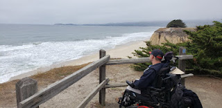
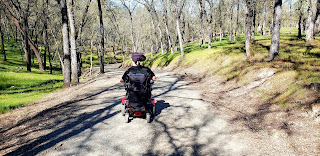
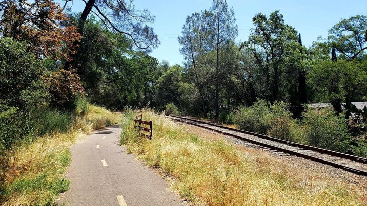
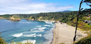
1. ELFIN FOREST, Baywood Park (Morro Bay) - So called because the coastal live oaks that grow here are stunted due to poor soil conditions and consant winds. They rarely get over 10 feet tall here.
A one mile interpretive, boardwalk train winds through the dunes here in the southern end of Morro Bay.
Although the trail has many trailheads, only the entrance on 16th Street is accessible. There are two handicapped parking spots, neither are paved but should not prove to be a problem.
In addition to exploring the little oak trees, interpretive stations explain the flora and fauna of the region in addition to telling stories of the Native Americans that used to live here. QR codes that you scan on your phone are used to explain each stop.
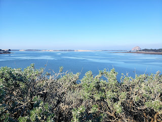
Along the trail, there are also a couple of spurs to viewpoints where you can get great views of the estuary and Morro Rock in the distance.
2. EARTHQUAKE TRAIL, Point Reyes National Seashore - A flat, paved, quarter-mile loop takes you to the San Andreas Fault and back.
You can see where a fence was torn in two during the 1906 San Francisco earthquake and the two sections displaces 16 feet from each other along with many other interpretive exhibits of tectonic geology.
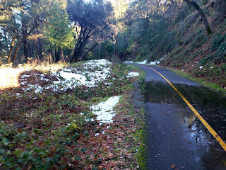
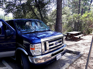
It's shady with a few meadows to transit but be aware of poison oak. Handicapped parking, accessible restrooms, and a picnic area with tables are at the trailhead.
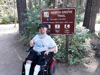
3. CALAVERAS BIG TREES, Arnold - A not quite two mile long trail runs through the North Grove in this state park giving you an up close and personal look at the largest living things on earth, the Giant Sequoia trees of California. Paved in parts, boardwalked in others, but mostly hard packed dirt, this mostly level trail can have some minor bumps along the way but almost any chair user can handle it.
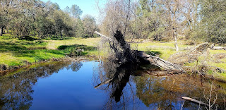
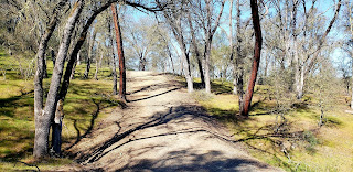
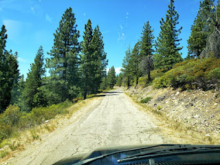
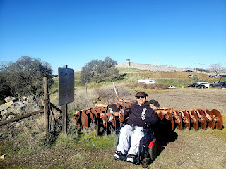
4. COOKS MESA, Campo Seco - Part of the Coast to Crest Trail, this spartan, rural trail along the banks of Lake Camanche in Calaveras County will give you a bit of a test.
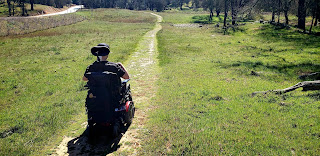
It's not paved but most of it is smooth graded. You share the trail with horses and bikes. The path from the trailhead (on Buena Vista Road south of Valley Springs) is the bumpiest part but can be handled by most chairs.
There are a few hills that can be a bit of a challenge along the way. The day we went, Tim's chair (which can usually go 5+ miles on a charge) barely made 3 miles...1.5 miles each way...and it was close. This is one of the toughest trails on this list. It is accessible but will challenge power chair batteries and manual users need to be in good shape or have pushers in good shape to come along.
Still, the scenery is very nice...rolling oak hills, a lake, seasonal streams...and views of wildlife can be had. We saw many hawks, vultures, a couple of bald eagles, jays, deer, squirrels. In the warmer months, snakes are not uncommon.
The area is owned by the East Bay Municipal Utility District and you must buy a pass online before using. Click on the links to get your pass.
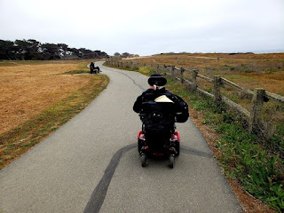
5. COAST TRAIL, Half Moon Bay - This 11 mile, mostly paved and all-accessible trail runs from Half Moon Bay Golf Links at the south end of the bay to Maverick's Beach at the north. Along the way, you'll travel on top of cliffs, roll through nature preserves, get in some bird watching, get close to the water, and...if you're lucky...see surfers tackle some of the biggest and most dangerous waves in the world.
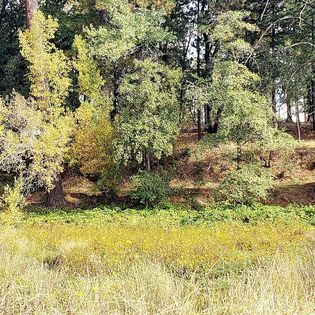
6. CONSUMNES RIVER PRESERVE, Galt - A one and a half mile accessible trail leads to wetlands, ponds, forests, and river habitat.
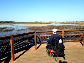
In the fall, thousands of sandhill cranes migrate to the ponds here. The trails are either paved, hard packed, or boardwalk and are very easy on wheelchairs.
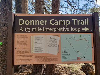
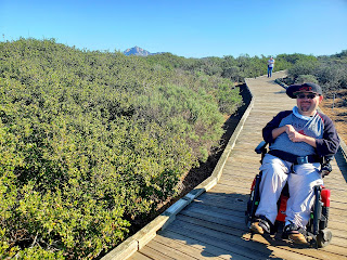
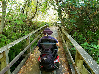
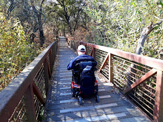
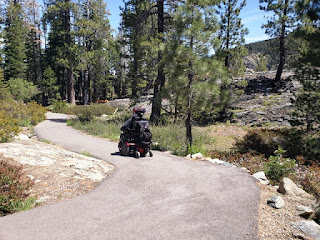
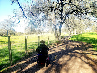
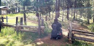
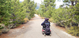
7. DONNER CAMP HISTORICAL TRAIL, Truckee - Most people have heard of the Donner Party tragedy that took place in the brutal winter of 1846-47 and a lot of people have visited the Donner Memorial near Donner Lake next to Interstate 80. There was also another camp, where the Donner's split off from the rest of the party, 6 miles away at Alder Creek, just north of Truckee.
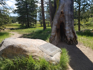
A 1/3 mile loop trail with interpretive markers map out the area the the Donner family made camp at, including a dead tree trunk marking where they made shelter. It is here that George Donner and his wife, Tamsen, met their ends, along with several others.
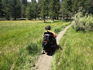
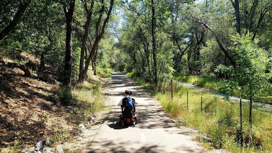
The trail can get narrow and a little rough at times but most wheelchairs can get through the hard packed dirt and occasional boardwalk. Tim is navigating the roughest and narrowest part of the trail, above.
8. FRAZIER FALLS TRAIL, Plumas National Forest - A true, high-altitude mountain trail to a large, Alpine waterfall is usually off-limits to wheelers but someone found a way to pave a trail that climbs over a rocky, boulder strewn ridge to get to two very nice viewing platforms for this fall.
Frazier Falls drops 176 feet down a glacier carved cliff 6,000 feet up into the Sierras. Just getting to the parking lot is an adventure. You'll need your own car to drive off of highway 89 near Graeagle to head west on Gold Lake Highway for a couple of miles, and then pay close attention to find Frazier Creek Road. It's another five miles on basically a single lane, potholed road where you will finally find a small parking lot with half a dozen spaces, one handicapped, and two accessible pit toilets.
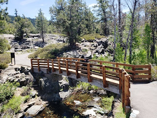
This is the trailhead. It's a quarter mile to a wooden bridge crossing Frazier Creek...the source of the falls...and another quarter over the ridge to the platform across the canyon to see the falls for a mile round trip.
The trail is smooth and paved the entire way and fairly level. There are a couple of small uphill sections that might challenge solo manual chair users but if you have someone to help push or are confident of your upper body strength, you should be fine. Power chairs will have no problems, just make sure your battery is charged.
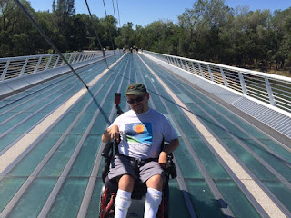
9. SUNDIAL BRIDGE, Redding - A stunning landmark which is an actual and giant sundial, crosses the Sacramento River here in Redding and connects to the 12 mile accessible Sacramento River Trail on the other side. There's also a zoo and botanical garden here on either side of the bridge (bridge and trails are free, entrance fees apply to the zoo and garden).
10. EL DORADO TRAIL (Mississippi Flat to Placerville), Placerville - El Dorado County has a goal to build a trail that goes all the way from the county line in the west end of the county, near Latrobe, to Lake Tahoe at the eastern end. So far, they have made it to Camino, which is the home of the famous and popular Apple Hill area.
The part of the trail that runs from the western side of Placerville to Camino is paved and is wheelchair accessible. That section is a little less than 15 miles.
We hiked the five mile section from Missouri Flat Road, on the west end, to downtown Placerville in the east. There are no bathrooms on this route, although there are at the downtown end.
A small parking lot is at the trailhead here (nextdoor to Sierra Door company but do not park in their lot) with two handicapped parking spaces. If the lot is full, you can also park at the Walmart, across the street.
With very little elevation to speak of, it's not a hard trail. We chose it because we could end up on a street with several good restaurant options to finish up our hike with.
It's a very scenic trail leading past cow pastures, forests, and peoples backyards.
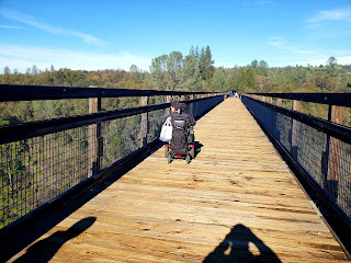
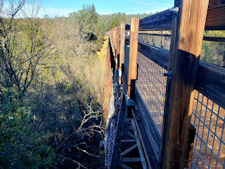
The highlight of the trail is crossing the old railroad trestle that crosses high over Weber Creek.
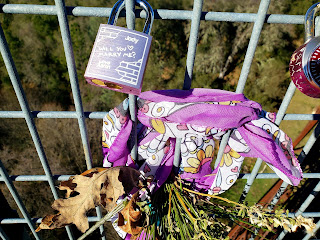
It's been upgraded with a flat, wooden deck and fence on each side that people leave "love locks" on.
11. EL DORADO TRAIL (El Dorado Station to Mississippi Flat), Placerville - The westernmost, accessible (i.e., paved) portion of this very long county trail, takes you through the oak-studded foothills from the tiny hamlet of El Dorado to the western edge of Placerville where the sudden burst of civilization may be a bit of a shock after wandering through this very pretty and rural landscape.
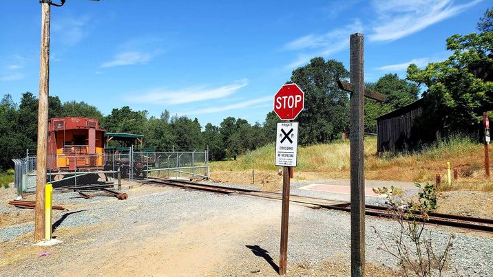
This segment of the trail starts next to the little train station of the El Dorado Western Railroad, a tourist train that runs from here to the nearby town of Shingle Springs on Sundays. A small parking lot with no marked handicapped spots (but not a problem) provides a place to leave your car. There are two restrooms here, built to be accessible, but a 6 inch gap is probably too hard for most wheelchairs to overcome so you may want to make sure you take your comfort break ahead of time. There’s also an adjacent community hall that may have facilities.
It’s 2.5 miles from here to the end of this segment at Missouri Flat Road, smooth asphalt the entire way. There are a few small hills along the way. Power chairs will have no issues nor will stronger manual users. Others may want to go with someone who can provide occasional pushing.
At the western end of the trail (El Dorado) there are a handful of restaurants. At the eastern end (Missouri Flat), you’re in a very busy commercial corridor with a Walmart, McDonalds, Panda Express, and much more. In between there are no restrooms, water fountains, or any signs of commercial activity.
12. JOHNNY CASH TRAIL, Folsom - A 6.3 mile trail that debuted in 2017 in this city just east of Sacramento. Starting at the Folsom Powerhouse State Park, this smooth, wheelchair accessible trail has an 839 foot elevation gain but most of that comes in the far eastern portion of the trail near Folsom Lake.
You can avoid most of that by taking the spur that leads to the gate of Folsom State Prison, where the namesake of this trail...Johnny Cash...performed two very historic concerts for the prisoners here.
Yes, the city is kind of cashing in on this by dropping his name on this trail but it is still a very nice trail, crossing a gurgling seasonal creek at Robber's Ravine and winding through hillside filled with wildlife.
The day we hiked it we saw great blue herons, wild turkeys, numerous mule deer, a coyote, and several grazing cattle. Parking is available near the Powerhouse trailhead and by the city library and zoo on Sutton Street a little east of the Powerhouse State Park.
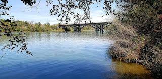
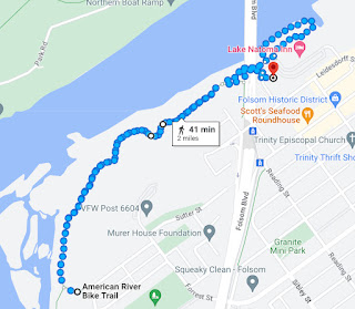
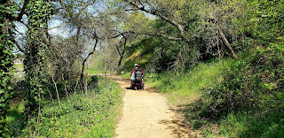
13. AMERICAN RIVER PARKWAY, Lake Natoma Segment, Folsom - Two miles, out-and-back, with the trailhead starting about 100 yards away from the Old Folsom light rail station at the south end of the Folsom Boulevard bridge. The trail also connects to the main American River Parkway (Jedediah Smith Trail) that winds all the way from Sacramento to Folsom Lake, which is also paved and accessible.
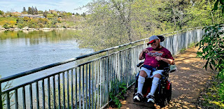
The trail winds down a long ramp to the edge of the American River, which at this point is a narrow lake...Lake Natoma...which is held in place by the Nimbus Dam further down the river. 90% of the trail is paved, the last 10% is hard packed dirt that should be fine for most wheelchairs but is a bit narrow in a couple of spots.
At the end of the wheelchair-accessible portion of the trail is an accessible picnic table so you might want to brings some snacks and drinks.
It's a very pretty trail that winds through some woodland portions before you hit the water's edge. You will navigate under the bridge. There's a personal watercraft launch ramp there...paved...that looks like a wheelchair path but be careful! It ends abruptly into water and you don't want to accidentally roll into the lake.
We saw plenty of waterfowl along the way. It's a very popular place for kayakers, stand up paddle boarders, canoers, etc. and, except for the long and not steep ramp from the trailhead, smooth and flat.
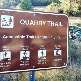
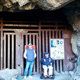
14. QUARRY TRAIL, Auburn - 1.3 miles (each way) of accessible, aggregate covered trail alongside the middle fork of the American River. The trailhead is located on highway 49, a few miles southeast of Auburn, and just south of the American River bridge.

There is a small, dirt parking area with one concrete pad for an accessible parking space. There is a $10 parking fee.
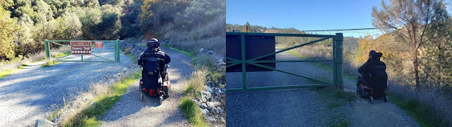
There is a ramp from that parking space that allows wheelchairs to bypass the gate on the trail but we found it was easier and not as scary to just go around the gate.
There is no restroom at the parking area but about 100 yards into the hike is an accessible pit toilet. There are also accessible porta-potties located about halfway into the hike and another at the far end of the trail.
The trail is on a former railroad bed so it’s wide, level, with no big elevation gains. It’s also pretty smooth for what is mostly a gravel trail. It shouldn’t pose a problem for the vast majority of wheelchairs both manual and powered.
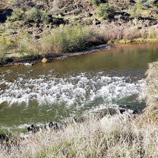
For most of the trail, the river will be alongside you. The vegetation is mostly brushy and the trail is on the shady side of the canyon. It can be pretty chilly in winter.
There are a few shade shelters with picnic tables at the end of the trail along with massive ruins of an old limestone mine to explore.
For the more adventurous, there is a steep one tenth of a mile side trail that takes you up to an old mine tunnel that is gated to keep out trespassers. You can look through the gate to see inside. Before it was a mine, it was a natural cave and many fossils have been found here.
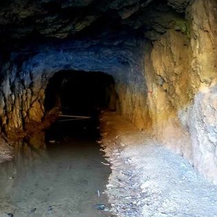
The short trail to the tunnel can be done with a heavy powered wheelchair. Manual users will need some sturdy pushers to help up the slope.
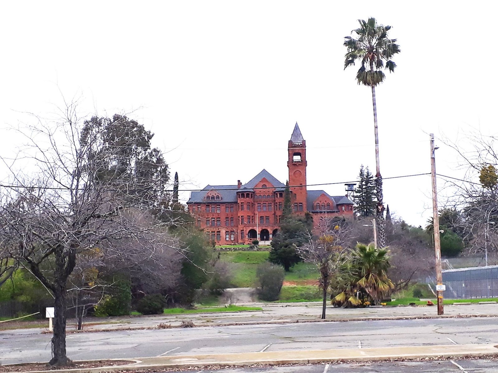
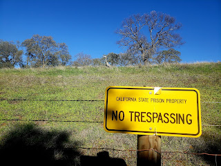
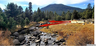
15. WATERMAN ROAD/PRESTON CASTLE, Ione - Preston Castle is a well-known landmark in Amador County. A former boy’s reform school, this massive brick Gothic edifice…opened in 1894…sits ominously on a hilltop overlooking the city of Ione. The state of California abandoned it in 1960 when a more modern facility was built next door. The modern juvenile hall closed in 2014 although it looks as though it could have been yesterday.
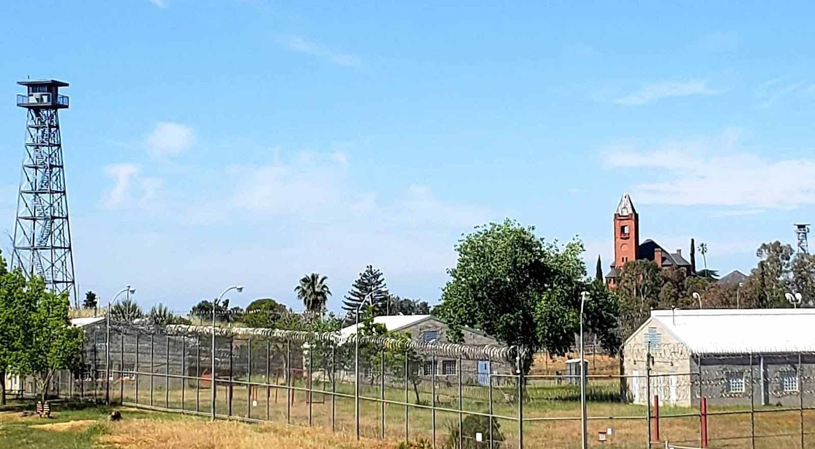
This route takes you up to the gates of the Castle and along the adjacent road that follows the razor topped fence of the more modern facility. Besides the prison-like scenery, you’ll pass huge areas of cow pasture, go down shady tree-lined country roads, seasonal creeks, ponds, and even a large estate at the north end of the route.
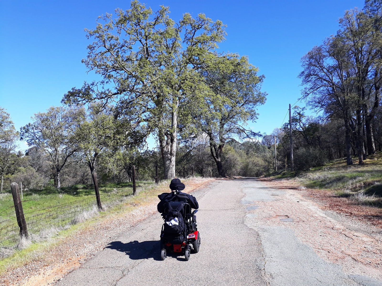
While this is a road open to traffic, we rarely see any cars coming down this poorly maintained pavement making it a good route for chairs of all types but do pay attention as you go.
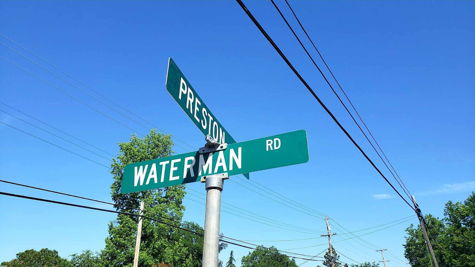
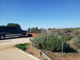
From the starting point at the corner of Preston Avenue and Waterman road, it’s. 1.3 miles to the other end of Waterman where it meets highway 124. It’s paved and accessible but it can be pretty bumpy in spots. Parking is available in the lot of the newer juvenile hall about a quarter mile east of that intersection where you also get the best view of the Castle (the lot in the photo at the beginning of this entry).
A round trip is not quite 3 miles but a trip up Palm Drive (back at the corner of Preston and Waterman) to the gate of the Castle will add another three quarters of a mile making it an easy 3.5 miles.
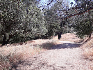
16. SUTTER AMADOR HOSPITAL WALKING TRAIL, Jackson - Not advertised (you won't find it on the Sutter hospital or Sutter Health websites) but there is a very nice little one mile, hard packed dirt loop next to the hospital that starts in a small meadow next to the outpatient parking lot where a sign denotes the start of the trail.
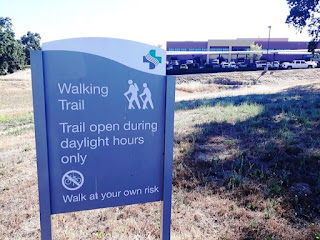
It loops down to the banks of Jackson Creek then up into the rolling hills behind the hospital. Free parking is available at the outpatient parking lot.
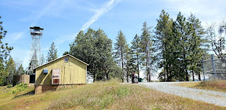
17. MOUNT ZION STATE FOREST, Pine Grove - At about 3,000 feet, just south of the town of Pine Grove, sits this 1.5 mile (out and back) trail to a mountain top.
From Highway 88, turn south on Mt. Zion Road, just past the Shell Station, for an easy 1 mile drive to the parking area. There are no restrooms, trash cans, or accessible parking but the regular parking area should be sufficient. A break in the fence allows access to the trail.
The "official" trail is not accessible but just follow the immediate left fork to go the the access road that is adjacent. Follow this road for 3/4 of a mile.
It's uphill but should pose no problem for power chairs. Manual users do need to be strong or have a strong pusher to help.
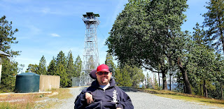
A fire lookout sits atop the mountain.
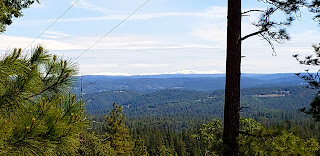
There are a number of areas to check out the view through the trees to the valley below or the mountains around Lake Tahoe to the east.
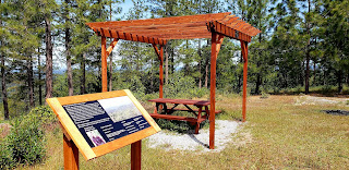
A lookout gazebo with a picnic table, built by a local Eagle Scout, provides a good rest stop for a picnic before heading back down.
18. LAKE TABEAUD, Pine Grove - This is a small, regulating reservoir owned by Pacific Gas and Electric, the local utility, that helps provide water pressure for the Electra power generating station located on the Mokelumne River, nearby.
The lake is located about 6 miles south of Pine Grove on Tabeaud Road. There is free parking in two lots and accessible picnic tables located adjacent to the accessible parking spots.
There are two trails that wheelchairs can use here, this report is on the south shore road…we will need to do the north shore trail at another time to complete this one.
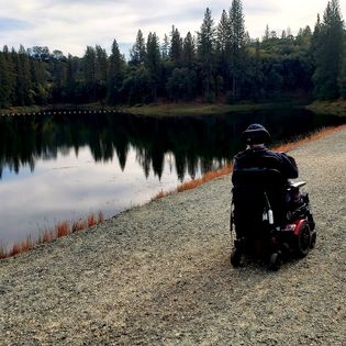
From the parking lot, a paved access road will take you around a small, forested hill to the lake’s dam. It’s a bit tricky getting around the gate but most chairs can do it with care. From there, you can roll across the top of the dam and for a small portion of the gravel road on the other side. The trail at the end of the dam that continues along the shore of the lake is not accessible at this point.


This trail only goes about 100 yards before a big, 12 inch pump pipe blocks the way so there really isn’t much more to hike in a chair than the south shore trail.
19. TRUCKEE RIVER BIKE TRAIL, Tahoe City - Starting at the outflow of the Truckee River as it drains Lake Tahoe, this trail goes for seven and half miles along the banks of the river. Traffic can get a bit heavy with bikes so keep you wits about you as you enjoy the river scenery filled with rafters heading down the gentle rapids.
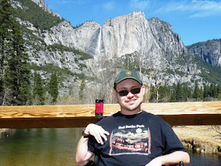
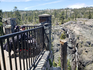
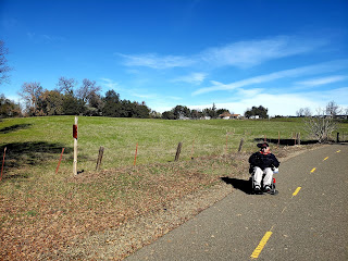
20. YOSEMITE VALLEY, Yosemite National Park - Not a single trail but a series made of of miles of accessible trails crisscross the Yosemite Valley taking you over the Merced River and affording million-dollar views of the sheer cliffs of the valley mountains and stunning waterfalls, including the tallest waterfall in the nation, Yosemite Falls (pictured behind Tim, above).
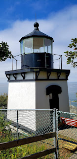
21. TRINIDAD HEAD TRAIL, Trinidad - Two trails diverge around this rocky, ocean outcrop, but only one is paved and smooth enough or wheelchairs.
It can be steep at the beginning of the trail but power chairs will have no problem. It can be tough for manual users.
Great views of Trinidad Bay and the state beach on the other side await the hiker.
At the end of the 1.4 mile trail is the small lighthouse, then it's all downhill going back down.
Accessible parking and restrooms are next to the pier near the trailhead.
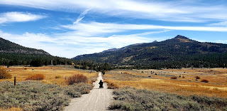
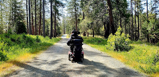
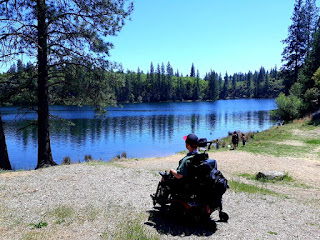
22. HOPE VALLEY WILDLIFE AREA - Hope Valley, Alpine County. To me, Hope Valley is just about the most stunningly beautiful place in California. At least a place that we can easily access. Nestled over the mountains about 20 miles south of Lake Tahoe and just a bit west of the Nevada/California state line, where the headwaters of the Carson River are located, the wildlife area features a paved road that takes you across the valley and ends up at Luther Pass (highway 89) after approximately 2 miles...which would make for a 4 mile roundtrip.
We were able to go 1 1/2 miles before Tim's battery started to fade which took us just inside the edge of the forest on the northern side of the valley (yes, we're waiting for a new battery so we can roam farther) for a 3 mile roundtrip.
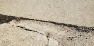
The road is mostly smooth, with a few bumps along the way, and pretty flat for at least a mile. The worst part is the part of the bridge, which crosses the Carson River near the beginning of the hike, that connects to the road on the other side. There is about an inch lip to navigate because of the degradation of the pavement on the other side (see pic, above).
There are also two wheelchair accessible fishing platforms with smooth access all the way from the parking lot if you feel like dipping a line. Other hikers in the area told us they had some good success there early in the morning and late in the afternoon.
About 3 handicapped parking spots are available in front of the very rustic but accessible vault toilet next to the trailhead. They're marked with signs but the paint on the pavement is pretty much worn away.
You need to buy a day or annual lands pass to hike here. You can buy one online at the California Department of Fish and Wildlife site before you go. Technically, you can get on on your phone from the parking lot but we found we had no phone service there.
The parking area is just a few feet west of the junction of highways 88 and 89 (Pickett's Junction). The trail is hikable from spring to fall...late fall through early spring would probably have too much snow on it to use.
No comments:
Post a Comment