Showing posts with label owens valley. Show all posts

Monday, May 29, 2017

The Road Less Taken - L.A. to Reno via Highway 395


"It's one of the most scenic drives in California," I tell my son.

"When does the scenic part start?" he replies.

Can't say I blame him all that much as you have to drive through a lot of ex-urban, partially developed desert land that would be more suited for a role in "Breaking Bad," before you get to the good part.

Prisons, large subdivisions, and the roads that are ill-suited to so many newcomers pushing into these communities just on the other side of the Cajon Pass from San Bernardino put a damper on this part of the drive.

"Be patient, it will be scenic in awhile."

Watch the Video!

Gradually, the last of the gargantuan Southern California's metropolitan sprawl passes by and we get to a more empty desert scenery sprinkled with ghost towns and lonely gas stations serving as rest stops for weary travelers.

Once we climb the grade that separates the desert from Owens Valley at the appropriately named Little Lake, the scenery does change dramatically.

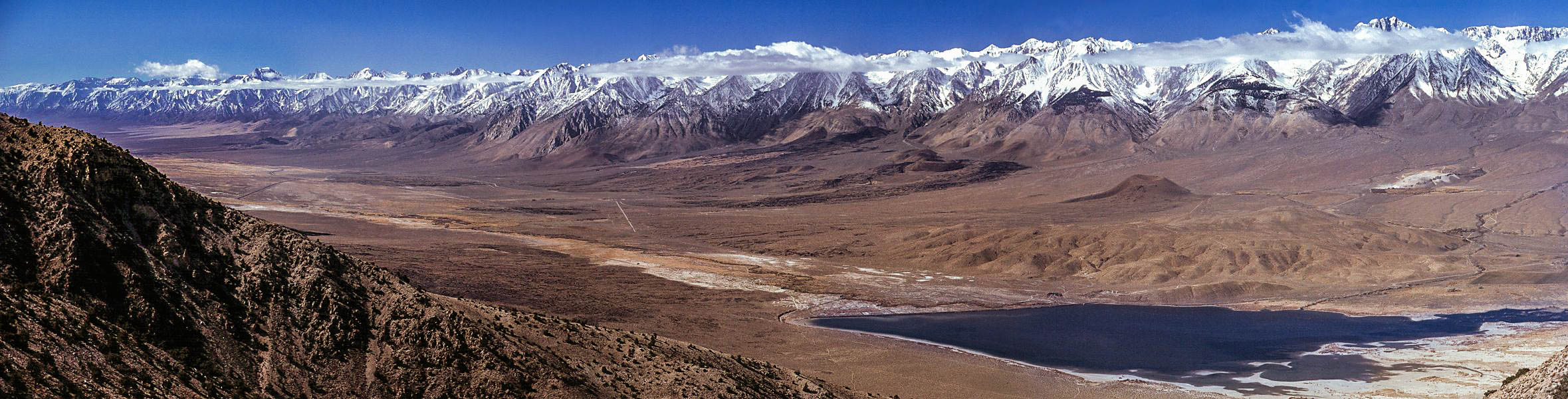
The mighty Sierra Nevadas line our left side view. It's not long before we pull over for a restroom break at Lone Pine to take a gander at snow and cloud draped Mt Whitney in the distance (see picture at the top of this post).


Still, my jaded son is going "I've seen mountains and desert before."

Oh well, you just can't please all the city lovers sometimes.

Soon, I'm pointing out historical points that my wife is slightly more interested in than Tim.

"There's the courthouse where they tried Charles Manson (in Independence)...John Wayne stayed at that hotel while shooting westerns in those rocks to the left...that mound on the left is a mass grave for earthquake victims...(and, most poignantly of all) that big, green building is all that's left of Manzinar."

Tim perks up a bit when we stop at Jack's Restaurant in Bishop...which will always be Jack's Waffle Shop to me...where it was a mandatory meal any time we drove up to Mammoth in my skiing days.

...and now a word from our sponsor.  We're very happy and long-time customers of Paul Kalemkiarian's Wine of the Month Club. We'd be pleased to see you become members, too. Now, all gift purchases get a free wine Accessory. Click the following link for some amazing wine deals: The Wine of the Month Club 45th Anniversary Sale. Thanks for your support, now back to the story...

Bishop also marks the point, about 3/5 of the way to our destination, where I need to fill the gas tank again so we stop at the Paiute Casino and gas stop at the end of town where my wife also buys some Indian fry break being cooked up in a little trailer in the parking lot.

Back on the road, we soon pass the aforementioned Mammoth Mountain, covered in a fat snow-filled cloud (hope it's a good season for them), then climb over Sherwin Summit at over 8,000 feet to get to Mammoth's sister resort of June Lake. 


Lee Vining and Mono Lake are next. Every time I drive through here, I think of Clint Eastwood's "High Plains Drifter," which was filmed along the shore.

Bridgeport is next, a town that gets so snowbound in winter that it'd make you think you're in Montana rather than California, with it's gas prices more than a dollar a gallon higher than what we paid in Bishop.  It gets so cold here that the Marines use it for cold weather warfare training at the Mountain Warfare Training Center located nearby.

Through the Walker River Canyon, where a tragic bus accident happened years ago and 3 airborne firefighters are memorialized with dozens of t-shirts and a roadside plaque near the spot where their C-130 tanker crashed fighting a blaze.

After this beautiful but sad canyon drive, Topaz Lake marks the state line with the ubiquitous casino. Down a hill, Gardnerville and Menden mark our entrance to Nevada's Carson Valley and our ultimate destination while we're here to take a look and see if we might want to retire here.


That's for tomorrow, though, as we continue north...maddeningly...along the highway as the governments here have decided to throw up an unsynchronized signal every now and then, turning a half hour drive into an hour plus when we finally reach our hotel in Reno, across the street from the Harrah estate.

It's been a long, nearly 10 hour drive but you can see the whole thing compressed into 6 minutes in the video above. For now, we'll turn in to our room at the Homewood Suites and continue this house hunters thing in the morning.

Darryl
Copyright 2014 - Darryl Musick
All Rights Reserved
Photos by Letty Musick
Copyright 2014 - All Rights Reserved

Friday, August 28, 2015

SOUTHERN CALIFORNIA: Highway 395 Kicks it Into High Gear - The Northern Owens Valley


It's been 275 miles on the road, probably time to think about somewhere to lay our head. That would be the heart and soul of the Owens Valley, Bishop, California.


With a population of just under 4,000, Bishop is the big city of Owens Valley. It's here that you'll find the major services...stores, hospital, casino, fairgrounds, and lodging. You can get clean, comfortable rooms starting at around $60 at the peak season of summer, up to the $140 dollar rooms at the Best Western Creekside Inn, the prettiest and most expensive place in town.


It's your choice but we'll not spend too much here...Bishop is unpretentious and uncomplicated. We'll keep it simple and cheap.

In Bishop, travelers stock up for the trip ahead. Sporting good stores cater to fishermen and hunters who flock to the local lakes and forests. It's said that you can walk across Crowley Lake, just north of town, by stepping from boat to boat on opening day of trout season. Campers get groceries and road trippers top off the tanks and drain the bladders for the road ahead.


While many just stop for a minute and continue on, Bishop rewards those who linger a little longer.  


Schatz Bakery is the busiest place in town where you can get varieties of bread and baked goods that range from mediocre to delicious. Grab a lunch to go and cross the street to the pretty city park where you can picnic on the banks of the creek, watching ducklings trying to keep up with mom.


You can get cheap gas and gamble for awhile at the Indian casino at the north end of town.


As we leave Bishop on highway 395, we also say goodbye to the Owens Valley.  42 miles north, although it seems much closer, we come the next big attraction...and I mean BIG.


Local DWP hydrographer Dave McCoy set up a number of rope tows to facilitate his love of skiing in the winter. In 1942, he finally found a good, snowy spot and persuaded the forest service to give him a permit to open a ski area. Mammoth Mountain was born.


The name is apt, the mountain is huge and easily accommodates the thousands of skiers and snowboarders that crowd the town of Mammoth Lakes on winter weekends.


Snow can come down hard here...it's not uncommon to drive the streets of this town in winter with walls of snow ten feet high on either side.


Skiing ranges from the easy bunny slopes to the truly scary and expert slopes of the 11,000 foot cornice.


It's not cheap to ski here.  As of this writing, an adult full day lift ticket is $89.  Rooms average around $200 a night in season, although we once found a small basement room for around $90. The closer to the lifts, the more expensive they get...easily topping $500 a night for a room next to a lift.


For that price, you will get one of the world's great skiing experiences. Mammoth also operates an adaptive ski program run by Disabled Sports Eastern Sierra that runs around $150 for a full day of skiing and instruction, click on that link for more information.

Back on 395, heading north, we leave all traces of desert behind as we travel through the snowy Alpine forests of the Sierra, Mammoth, and June Lake.  Where we're going is not the sunny California that everybody is thinking of.


We'll be swinging through the Siberia of the west coast in the next leg of this trip.


-Darryl
Copyright 2012 - Darryl Musick
All Rights Reserved

Monday, August 24, 2015

SOUTHERN CALIFORNIA: Highway 395 Kicks it Into High Gear - The Historic and Beautiful Southern Owens Valley


Either you bring the water to L.A. or you bring L.A. to the water.” – Noah Cross (John Huston) in Chinatown (1974).

It helps to know the importance of Owens Valley when you travel to it. What was rich farmland in the beginning of the 20th century became the main water source for the city of Los Angeles a couple of decades later. The thirsty city to the south drained much of the water that was here, turning much of it into desert. The Owens River ran dry which turned Owens Lake at the south end of the valley into an alkali flat.


Through much litigation and struggle, the city is slowing returning some of the water but it will never be the same in our lifetime.  Even so, this is one of the most ruggedly beautiful and historic areas in the state. The geography runs from  the highest point in the lower 48 to the lowest point in the entire country.

Coming up from the desert below on highway 395, you pass up some impressive lava formations at the Coso Mountains, on the east side of the highway past Pearsonville on up to Little Lake.

There is a beautiful little lake at the tiny town of Little Lake, marking your entrance into the southern end of the valley.  We’ll be here for another 140 or so miles before we exit via the northern end.

I like to divide the valley into two parts…the southern half and the northern half. Today, we’ll tackle the southern end.

The next town of any size along the highway will be Lone Pine.  This pretty little town sits between those two points of extreme, Mt. Whitney and Death Valley. Just to the west of town, amidst a collection of spires, sits the summit of Mt. Whitney, the highest point in the continental United States at 14,497 feet.


From the middle of town, you can drive up Whitney Portal Road quite a ways up the side of the mountain to the trailhead where hearty hikers can go the rest of the way.  We like the large waterfall here where on warmer days you can have a nice picnic. In the winter, if you can get up here, the waterfall is a spectacular frozen column of ice.


On the way back to town, you’ll see some familiar looking rock formations to the north of the road. These are the Alabama Hills and the recreation area is great to roam around, scramble on the rocks, and even have a picnic. Many, many movies, TV shows, and commercials have been filmed here which is why they look so familiar. You can download a map from the Lone Pine Chamber of Commerce to see where some of the more famous movie locations are.


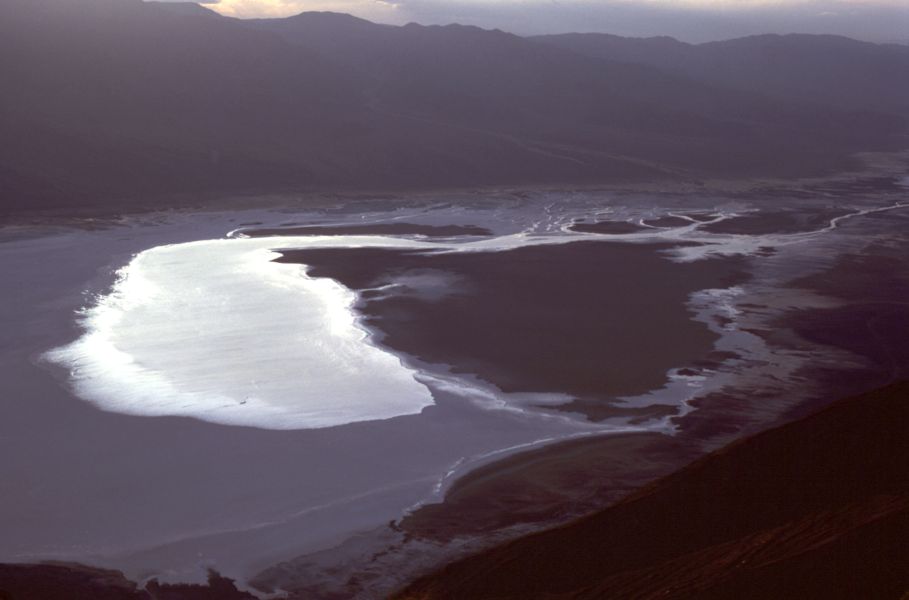
It’s about 85 miles southwest from the nearly 15,000 foot peak of Mt. Whitney to the Badwater in Death Valley. At 282 feet below sea level, it’s the lowest point in the United States.  You can go back to Owens Lake and take highway 190 over to this spectacular national park but, for us, that’s a trip for another day.

After a slice of pizza and a sandwich at the Pizza Factory in town, it’s back on the road. Just north of Lone Pine on the east side of the road you’ll see a small hill with a wooden fence, a monument, and a historical marker (no. 507) sign.

Sixteen bodies lay under the dirt here in a mass grave, the result of a massive earthquake in 1872. About 80 structures stood in town, mostly made of adobe which crumbled readily during the shaking. Only 20 structures were left standing and 27 people were left dead. Those that weren’t buried in their own services were interred here.


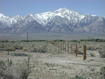
Seven miles north of town lies another melancholy site. Manzanar National Historic Site covers the area that was the Manzanar Relocation Center. During World War II, 10,000 people of Japanese descent were rounded up and put here for the duration of the war.


Manzanar in 1942


The camp was closed and mostly dismantled in 1945. For years, it was left alone out here in the bottom of the valley. We’d stop in and have the 550 acres to ourselves to explore. In 1985, forty years after it was shut down, it was declared a National Historic Site.


Manzanar today


Today, you can still explore the grounds, see the foundations of the barracks, see the couple of remaining structures like the gymnasium and the guardhouse, and visit the accessible interpretive center.


Continuing north, we come into the county seat of Inyo County, the town of Independence. Be sure to make a stop to see the old courthouse in the center of town. It was here, a group of vagrants were brought for hearings after being arrested in a remote area of Death Valley. One of them was named Charles Manson, who would eventually be taken to Los Angeles for the murder trial he is infamous for.

On the drive north, it takes little reminding to enjoy the view. The mountain ranges on either side…the steep, abrupt eastern escarpment of the Sierras and the gentler slopes of the White Mountains on the right…both rise over 14,000 feet. In the winter the view doesn’t get any better.

Passing out of Independence, we continue on this classic and legendary highway heading toward the northern half of the stark, barren, and exceptionally stunning Owens Valley.

-Darryl
Copyright 2012 – Darryl Musick
All Rights Reserved