Showing posts with label highway 395. Show all posts

Monday, May 29, 2017

The Road Less Taken - L.A. to Reno via Highway 395


"It's one of the most scenic drives in California," I tell my son.

"When does the scenic part start?" he replies.

Can't say I blame him all that much as you have to drive through a lot of ex-urban, partially developed desert land that would be more suited for a role in "Breaking Bad," before you get to the good part.

Prisons, large subdivisions, and the roads that are ill-suited to so many newcomers pushing into these communities just on the other side of the Cajon Pass from San Bernardino put a damper on this part of the drive.

"Be patient, it will be scenic in awhile."

Watch the Video!

Gradually, the last of the gargantuan Southern California's metropolitan sprawl passes by and we get to a more empty desert scenery sprinkled with ghost towns and lonely gas stations serving as rest stops for weary travelers.

Once we climb the grade that separates the desert from Owens Valley at the appropriately named Little Lake, the scenery does change dramatically.

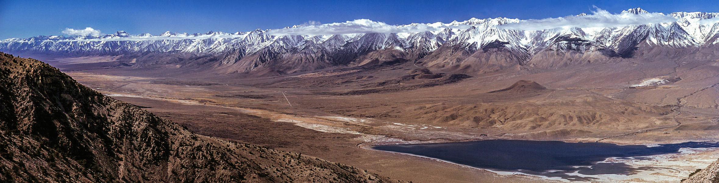
The mighty Sierra Nevadas line our left side view. It's not long before we pull over for a restroom break at Lone Pine to take a gander at snow and cloud draped Mt Whitney in the distance (see picture at the top of this post).


Still, my jaded son is going "I've seen mountains and desert before."

Oh well, you just can't please all the city lovers sometimes.

Soon, I'm pointing out historical points that my wife is slightly more interested in than Tim.

"There's the courthouse where they tried Charles Manson (in Independence)...John Wayne stayed at that hotel while shooting westerns in those rocks to the left...that mound on the left is a mass grave for earthquake victims...(and, most poignantly of all) that big, green building is all that's left of Manzinar."

Tim perks up a bit when we stop at Jack's Restaurant in Bishop...which will always be Jack's Waffle Shop to me...where it was a mandatory meal any time we drove up to Mammoth in my skiing days.

...and now a word from our sponsor.  We're very happy and long-time customers of Paul Kalemkiarian's Wine of the Month Club. We'd be pleased to see you become members, too. Now, all gift purchases get a free wine Accessory. Click the following link for some amazing wine deals: The Wine of the Month Club 45th Anniversary Sale. Thanks for your support, now back to the story...

Bishop also marks the point, about 3/5 of the way to our destination, where I need to fill the gas tank again so we stop at the Paiute Casino and gas stop at the end of town where my wife also buys some Indian fry break being cooked up in a little trailer in the parking lot.

Back on the road, we soon pass the aforementioned Mammoth Mountain, covered in a fat snow-filled cloud (hope it's a good season for them), then climb over Sherwin Summit at over 8,000 feet to get to Mammoth's sister resort of June Lake. 


Lee Vining and Mono Lake are next. Every time I drive through here, I think of Clint Eastwood's "High Plains Drifter," which was filmed along the shore.

Bridgeport is next, a town that gets so snowbound in winter that it'd make you think you're in Montana rather than California, with it's gas prices more than a dollar a gallon higher than what we paid in Bishop.  It gets so cold here that the Marines use it for cold weather warfare training at the Mountain Warfare Training Center located nearby.

Through the Walker River Canyon, where a tragic bus accident happened years ago and 3 airborne firefighters are memorialized with dozens of t-shirts and a roadside plaque near the spot where their C-130 tanker crashed fighting a blaze.

After this beautiful but sad canyon drive, Topaz Lake marks the state line with the ubiquitous casino. Down a hill, Gardnerville and Menden mark our entrance to Nevada's Carson Valley and our ultimate destination while we're here to take a look and see if we might want to retire here.


That's for tomorrow, though, as we continue north...maddeningly...along the highway as the governments here have decided to throw up an unsynchronized signal every now and then, turning a half hour drive into an hour plus when we finally reach our hotel in Reno, across the street from the Harrah estate.

It's been a long, nearly 10 hour drive but you can see the whole thing compressed into 6 minutes in the video above. For now, we'll turn in to our room at the Homewood Suites and continue this house hunters thing in the morning.

Darryl
Copyright 2014 - Darryl Musick
All Rights Reserved
Photos by Letty Musick
Copyright 2014 - All Rights Reserved

Friday, September 4, 2015

CALIFORNIA/NEVADA: Highway 395 and Nevada's Capitol - Carson City


After crossing the border we’re no longer in the Golden State. We’ve stepped over to a new metal…the Silver State of Nevada. Coming up on highway 395, the mountains drop away from under the road, giving way to the green expanse of the Carson Valley, guarded on the south by the towns of Gardnerville and Minden.


The steep, rocky Sierras still peer at us on the left where they hide the beautiful Lake Tahoe just over that ridge.


It’s not long before we roll into the capitol of the state, Carson City.  It’s not a huge place…Vegas and Reno are both much bigger…and before we know it, we’re downtown and hungry.


Smack in the center of downtown is the Nugget Casino where we can while away a little time at the slot machines and roulette table before heading into the coffee shop to get one of the great under $10 prime rib dinners you’ll get in a casino. Not Morton’s, but for the price it’s hard to beat this tasty, tender slab of meat served with baked potato, veggies, and salad.

We need to keep heading north where we’ll find Washoe Lake. Turning in from the highway, it’s along the eastern side of the lake…home to a family of bald eagles…where we’ll find our bed for the night at the Deer Run Ranch run by David and Muffy Vhay.


Picture courtesy of Wikimedia
Rick Cooper under CC BY 2.0 license


The Vhay’s run an alfalfa farm here and David built this eco-friendly inn into the hillside near the barn.  The name comes from the herds of deer that roam the alfalfa fields where you can see antlers sticking up above the stalks.

It’s a wheelchair-accessible escape far from the busy cities and highway nearby. Bullfrogs croak in the pond and owls nest in the barn. Many varied guests…from the family looking to get back to nature to the gentleman who comes into town for a brothel tour…enjoy the quiet surroundings.

Over breakfast, after David tells us about the brothel fan (he’s not here today), he explains the process of growing and, more importantly, selling the alfalfa nearby. He gives discounts to local ranchers who come and pick it up, saving him the cost of delivery.


Upon checkout, we travel slowly along the banks of the lake looking for the eagles but are not having luck today. It’s back on 395 as we head up the the “biggest little city in the world,” Reno.


We try our luck at the Horseshoe Casino but the heavy smoke and the depressing empty buildings nearby tell us we should move on.


North of the city, we finally leave the ribbon of asphalt that we’ve been celebrating these last two weeks and head west on the big Interstate 80 back towards California.


A bit west, over the state line, following the river of the same name, we end up in the cute town of Truckee.  Truckee is a legendary train town. The station still serves passenger trains coming up from the Bay heading for Denver and Chicago.


The downtown area surrounding the station holds many boutiques, high priced snack shops, and a couple of really good restaurants.


After spending some time here, we turn south at the end of town and follow the Truckee River up the mountain to its source on the north shore of Lake Tahoe where we picnic on deli sandwiches and throw fish food to the giant…and I mean GIANT…rainbow trout living in the protection of the “no fishing” zone where the river begins.


From Reno, highway 395 continues its course back across the border along California’s eastern frontier, into Oregon and the cold, high country desert before reaching Pendleton and crossing over to southern Washington’s tri cities of Pasco, Kennewick, and Richland.

Continuing north, you can follow it to Spokane and beyond, where it finally terminates across the Canadian border where it meets highway 3 in central British Columbia.


Not this trip, though. We say goodbye here in the beautiful high country on the border of Nevada and California on the edge of Lake Tahoe, not far from the mythical Ponderosa.


Truly a different take on California, highway 395 is a beautiful road connecting some of the most lonely, stark, and historical areas of this Golden State.


-Darryl
Copyright 2012 – Darryl Musick
All Rights Reserved

Monday, August 31, 2015

CALIFORNIA - Our Highway 395 Road Trip Moves Into the Cold Country

Follow Me on Pinterest1


Although the area seems relatively flat, the snow and trees give a clue. Just a few miles after leaving Mammoth, highway 395 hits the altimeter at 8,036 feet at Deadman Summit.
An exit leads to June Lake Loop, a back country of lakes, campgrounds, and the June Lake ski area, also owned and operated by the same folks back in Mammoth. We’ve yet to try it out but I’m told if you don’t like the crowds at Mammoth, June Lake makes a great alternative.


Coming down the other side of the summit a very large lake looms in the distance. This is Mono Lake, a brackish, fragile eco-system full of alien looking towers called tufa. 
As L.A. took all the water in this area, they also diverted the streams feeding the lake which has no outlet.  Mono Lake shrunk to the point where islands that supported nesting birds became peninsulas giving predators a bridge to the tasty birds.
Many court battles later, the streams are no longer being diverted and Mono Lake is making its comeback.


The tiny town of Lee Vining sits to the west of the lake, a nice rest stop along the highway.  Closer to the lake, fans of Clint Eastwood movies might recognize the area of the town he had painted red in High Plains Drifter.

At the south end of town, highway 120 begins its westward trek toward Yosemite National Park. Better known as Tioga Pass, this road is blocked by snow and rubble for much of the year. It’s only in the warmer summer season and into fall that you can actually drive that route.


Just north of town, you can pull off to see the crazy tufa formations at the Mono Lake Tufa State Reserve.
Past Lee Vining, we’re climbing again. This time to the 8,138 foot height of Conway Summit, the highest elevation along 395.  Coming down from the summit, if you’re here in the peak of summer,you might want to take the detour to Bodie, one of the best preserved ghost towns in the country, a few miles to the east. Now, in the winter, the high country road is closed.

The next big town we come into is Bridgeport, a very pretty little high country town in a valley alongside the Bridgeport reservoir.  I’d been coming here for years…all in the winter…before I realized there was a lake here.  Mostly, I’ve seen the town under a deep blanket of snow where the gas prices will take your breath away.

It gets so cold up here that the Marines maintains their cold weather and mountain training facility to the west of town.  This is not the California of beaches and palm trees you see on the post cards.
Past Bridgeport, we become partners with the Walker River adjacent to the road.  The canyon narrows as we get closer to the state border, a lonely spot with the requisite small casino, Topaz Lake. The Best Western here actually looks like it’d be a great place for a get-away-from-it-all weekend.


After crossing into Nevada, we stop in Gardnerville to have dinner at the Overland Hotel. It’s a creaky old place with a bar and a dining room serving Basque fare.
Being seated, we are given a small carafe of wine, salad, soup, beans, and spaghetti before we’re even asked what we want for an entrĂ©e.  We get our steak and fish next, along with some great fries before having a little ice cream for dessert. All very good and filling.
Well fed, we head out back to our car where we join a short Frisbee toss with the kids living behind the hotel. It’s a short drive to our next overnight stop, Carson City, the capitol of the state where we’ll spend the night with owls, deer, and bullfrogs on an alfalfa farm.
-Darryl
Copyright 2012 – Darryl Musick
All Rights Reserved.

Pin It

Monday, August 24, 2015

SOUTHERN CALIFORNIA: Highway 395 Kicks it Into High Gear - The Historic and Beautiful Southern Owens Valley


Either you bring the water to L.A. or you bring L.A. to the water.” – Noah Cross (John Huston) in Chinatown (1974).

It helps to know the importance of Owens Valley when you travel to it. What was rich farmland in the beginning of the 20th century became the main water source for the city of Los Angeles a couple of decades later. The thirsty city to the south drained much of the water that was here, turning much of it into desert. The Owens River ran dry which turned Owens Lake at the south end of the valley into an alkali flat.


Through much litigation and struggle, the city is slowing returning some of the water but it will never be the same in our lifetime.  Even so, this is one of the most ruggedly beautiful and historic areas in the state. The geography runs from  the highest point in the lower 48 to the lowest point in the entire country.

Coming up from the desert below on highway 395, you pass up some impressive lava formations at the Coso Mountains, on the east side of the highway past Pearsonville on up to Little Lake.

There is a beautiful little lake at the tiny town of Little Lake, marking your entrance into the southern end of the valley.  We’ll be here for another 140 or so miles before we exit via the northern end.

I like to divide the valley into two parts…the southern half and the northern half. Today, we’ll tackle the southern end.

The next town of any size along the highway will be Lone Pine.  This pretty little town sits between those two points of extreme, Mt. Whitney and Death Valley. Just to the west of town, amidst a collection of spires, sits the summit of Mt. Whitney, the highest point in the continental United States at 14,497 feet.


From the middle of town, you can drive up Whitney Portal Road quite a ways up the side of the mountain to the trailhead where hearty hikers can go the rest of the way.  We like the large waterfall here where on warmer days you can have a nice picnic. In the winter, if you can get up here, the waterfall is a spectacular frozen column of ice.


On the way back to town, you’ll see some familiar looking rock formations to the north of the road. These are the Alabama Hills and the recreation area is great to roam around, scramble on the rocks, and even have a picnic. Many, many movies, TV shows, and commercials have been filmed here which is why they look so familiar. You can download a map from the Lone Pine Chamber of Commerce to see where some of the more famous movie locations are.


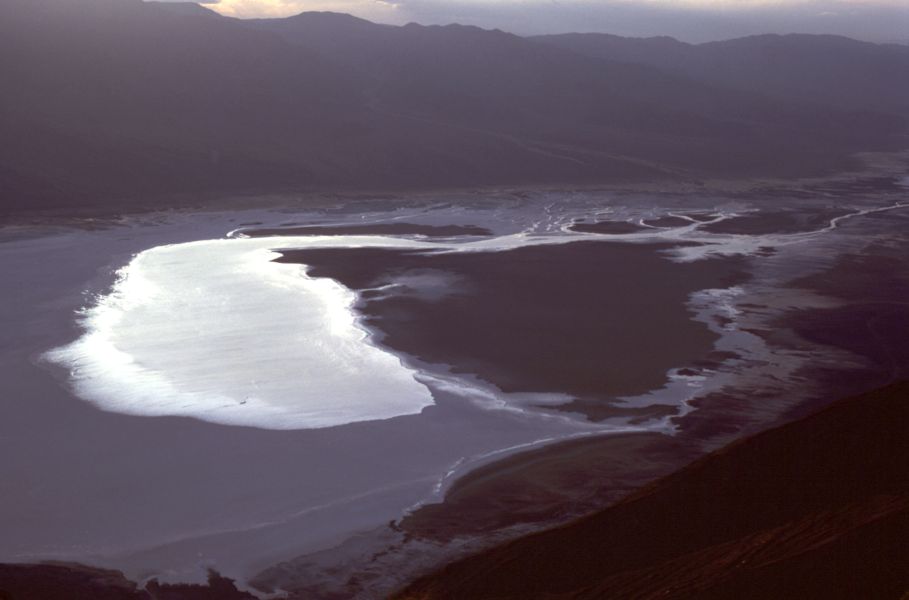
It’s about 85 miles southwest from the nearly 15,000 foot peak of Mt. Whitney to the Badwater in Death Valley. At 282 feet below sea level, it’s the lowest point in the United States.  You can go back to Owens Lake and take highway 190 over to this spectacular national park but, for us, that’s a trip for another day.

After a slice of pizza and a sandwich at the Pizza Factory in town, it’s back on the road. Just north of Lone Pine on the east side of the road you’ll see a small hill with a wooden fence, a monument, and a historical marker (no. 507) sign.

Sixteen bodies lay under the dirt here in a mass grave, the result of a massive earthquake in 1872. About 80 structures stood in town, mostly made of adobe which crumbled readily during the shaking. Only 20 structures were left standing and 27 people were left dead. Those that weren’t buried in their own services were interred here.


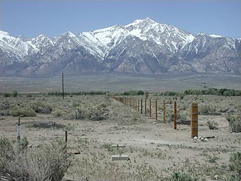
Seven miles north of town lies another melancholy site. Manzanar National Historic Site covers the area that was the Manzanar Relocation Center. During World War II, 10,000 people of Japanese descent were rounded up and put here for the duration of the war.


Manzanar in 1942


The camp was closed and mostly dismantled in 1945. For years, it was left alone out here in the bottom of the valley. We’d stop in and have the 550 acres to ourselves to explore. In 1985, forty years after it was shut down, it was declared a National Historic Site.


Manzanar today


Today, you can still explore the grounds, see the foundations of the barracks, see the couple of remaining structures like the gymnasium and the guardhouse, and visit the accessible interpretive center.


Continuing north, we come into the county seat of Inyo County, the town of Independence. Be sure to make a stop to see the old courthouse in the center of town. It was here, a group of vagrants were brought for hearings after being arrested in a remote area of Death Valley. One of them was named Charles Manson, who would eventually be taken to Los Angeles for the murder trial he is infamous for.

On the drive north, it takes little reminding to enjoy the view. The mountain ranges on either side…the steep, abrupt eastern escarpment of the Sierras and the gentler slopes of the White Mountains on the right…both rise over 14,000 feet. In the winter the view doesn’t get any better.

Passing out of Independence, we continue on this classic and legendary highway heading toward the northern half of the stark, barren, and exceptionally stunning Owens Valley.

-Darryl
Copyright 2012 – Darryl Musick
All Rights Reserved

Friday, August 21, 2015

SOUTHERN CALIFORNIA: A High Desert Drive up Highway 395

While the world rhapsodizes about the mother road, Route 66, many old time state residents also remember another road...Highway 395.


We’re working our way up this old road but we’ve yet to actually put the rubber on that road. After some time exploring the area between the L.A. Basin and the desert in the mountains of the Cajon Pass, it’s back on Interstate 15…395’s replacement here…to finish the climb to the desert.

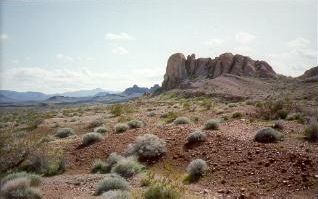
That’s right…climb.   Southern California has two distinct deserts going informally by the low desert and the high desert.  The low is an extension of the Sonoran desert and truly does get low…way below sea level near the Salton Sea. The high desert is the Mojave desert and averages around 3,000 feet in elevation. It can get bone-chillingly cold here in winter and regularly gets dusted with snow. As we exit the Cajon Pass , we’re at just under 3,200 feet.


Just before civilization, the sign of the Outpost CafĂ© tells us we’ve finally found the road. Highway 395 cuts a line due north from this junction, bypassing the towns of Hesperia and Victorville.  When real estate prices were booming, thousands of families came up here to escape the high prices down below. A large portion of them commute hours each way to jobs in Los Angeles and beyond.


Adelanto is the first town along this road. Home of historic George Air Force base (now a civilian airport) it’s not too far to the west where space shuttles would occasionally land on the dry lake at Edwards Air Force base when Florida weather was bad.  You’ll pass the stadium for the minor league High Desert Maverick’s baseball team as you head out of town.

Shop at eBags.com


As we leave Adelanto, we also say goodbye to the last remnants of Los Angeles’ suburbs. We are truly beyond civilization now.
After driving several miles, the next spot that can be called civilization is Kramer Junction where 395 intersects with highway 58 connected Barstow to the east with Bakersfield to the west. You can stop here for expensive gas and a snack but we’ re just moving on.


The old mining town of Johannesburg is a photographer’s delight with all the rusting mine equipment strewn about. Just beyond that, the huge China Lake Naval Weapons facility supports the town of Ridgecrest. It’s not uncommon to see military planes taking target practice to the right of the road as you pass through.
Someone had to have been sick of traveling through this large desert to found the next little spot on the road called Dunmovin.  It, and the other town nearby, Pearsonville, mark the end of the desert drive for us. Now it’s a climb up the hill to Olanch, Little Lake and the start of the next part of our 395 adventure, the historic and very important Owens Valley.

That's the next big stop on this road trip.

468x60 - Unpublished Rate Hotels


-Darryl
Copyright 2012 – Darryl Musick
All Rights Reserved