

New hike added - January 2018. Eaton Canyon, scroll down below.
This list is Kind of old, I admit (but we do have a few new ones now - Ed). Problem is we tried to get Tim into doing more outdoor and “nature” related activities, but this just doesn’t seem to be in his DNA. Tim is the first to admit, he’s a city boy at heart. In the meantime, here are some really good wheelchair accessible hiking trails located from Southern to Central California. Being accessible means they’re not going to be mountain climbing challenges, but are more than the “loop around the parking lot” that many state and national parks have as their accessible trails.
Unfortunately, it’s been several years since I’ve been on any of these trails so very little of it is updated. Happy trails!
We like to hike and enjoy nature, but let’s face it...trail planners just don't take into account the many wheelchair users that would also like to hike. There are a few places to enjoy and many more that could be enjoyable with just a little effort on the part of those who maintain the trails.
What follows is a list of good wheelchair accessible hikes and walks. These trails are also good for those who would like an easier, flatter walk than most backcountry trails provide. Every trail on this list is fully accessible for wheelchairs.
I received a list a possible wheelchair accessible hikes from Tom Chester. Tom runs the best general hiking web site for our local mountain at his Hikes in the Angeles Forest web page. Check it out for your general, non-wheelchair hikes. It's an excellent resource with links to all kinds of other goodies too. I particularly enjoy the link to hikes with aircraft wreckage.
ARROYO SECO, PASADENA
This is the second-best wheelchair route we've yet found locally (see the next hike for the best one). It'll take you awhile to get out of civilization here...about 1/2 mile...but then you enter a beautiful birch forest with a babbling brook along side.
You'll want to pack along a water bottle or two and at least some snacks. There is a drinking fountain about a mile up from the parking lot. Plan for at least a couple of hours. There is some parking near the gate in a paved parking lot. There are no designated handicapped spaces but about 4 spots can easily be used for van access. Unfortunately, they are first come, first served for everybody. There are no toilets here at the parking lot and we didn't see any more on the trail, but we may have missed them. There is a passageway to the left of the main gate with ample room for any wheelchair to pass through. Cars are not allowed on the trail.
Soon out of the parking lot, you will stroll past several back yards to the east and spectacular views of the Jet Propulsion Laboratory to the west and the Hahamongna Watershed Park (formerly Oak Grove Park, the home of Frisbee golf) just below that.
After the last turnoff to JPL, civilization ends and the forest begins. This is one of the prettiest birch forests I've seen around here, marred slightly be the barb-wire topped fence to keep hikers out of Pasadena's drinking water. Where the fence starts, there's a small diversion dam where you can see the water being sucked out to start its pipeline journey down the mountain.
We didn't see any waterfalls but we admittedly didn't go up too far. We stopped on the far side of the third bridge we crossed at a small picnic area called "Teddy's Outpost". We did come across some others who said there was a fall further up. There was also a tempting, paved turnoff to El Prieto Canyon and Millard Canyon. We know from experience, however, that there's a gate barring further access at the end of that road at the Millard Canyon campground.
The trail starts off paved, and continues paved towards El Prieto, for about a mile. Hard-packed dirt takes you up into Arroyo Seco from here and is still very negotiable. The trails winds along the bottom of the canyon and has a very easy elevation gain.
To get here, take the 210 freeway northeast from Pasadena and exit at Windsor Ave. Turn right (north) and follow Windsor up to the parking area just before Ventura Ave. The trailhead is about 100 yards north of the parking area.

Photo courtesy of Wikimedia
eekster under CC-BY license
This is just about our favorite hiking trail. From the trailhead, the elevation gradually increases 600 feet over 6.5 miles. The entire route is paved and motorized traffic is heavily restricted...only workers and cabin owners are allowed to drive on the road. The gate that blocks access for cars allows hikers, wheelchair, and bikes through via a big turnstile.
You'll want to pack along a couple of water bottles and a picnic or some snacks. Plan for an all day adventure here. There is some parking near the gate in the dirt and a full, paved parking lot across a bridge that has 2 handicapped spaces. There are accessible pit toilets here at the parking lot, at the 3.5 mile spot, and at the campground located at the end of the 6.5 miles.
The river is your constant companion as you hike this trail. Anglers can set up anywhere along the river (don't forget a license), however past the 1 mile marker, only baitless "catch & release" without barbed hooks can be done. That is because this stretch of river is the last wild trout stream in Southern California. A natural population of Golden Trout inhabits these waters. There are 3 wheelchair accessible fishing platforms along the trail, the first one located near the 3.5 mile marker.
There are lots of waterfalls along the way. Last summer we counted 12.
There are lots of trees here and it is very clean and quiet after the first 1/4 mile (the area where you start is a very popular swimming hole with some graffiti and trash). There is a campground at the end of the 6.5 miles with tables and restrooms that make a great place to picnic before heading back. It is possible to continue on the trail to Cogswell Resevoir but the trail gets very steep after the 6.5 mile point.
To get here, take the 210 freeway east from Pasadena and exit at Azusa Ave. (highway 39) in Azusa. Turn left (north) and follow Azusa Ave. right up into the mountains. There is a recreational use fee to enter the canyon...Golden Access holders get 50% off of this rate (there is a $100 fine if you are parked in the canyon without this). There is a kiosk to pay this fee at the entrance. Continue up the canyon 1 mile past the East Fork Road bridge, just past the off-road vehicle area. The next bridge you see is where the trailhead is. If parking is available on the south side of the bridge, park there. Otherwise, there is another parking lot on the north side.
.jpg)
Photo courtesy of Wikimedia
Mel under CC-BY-SA license
This trail takes you into a lovely, foothill oak forest in the San Gabriel Mountains just north of Glendora. The route is paved and makes for easy navigation via a wheelchair. There is a gurgling creek (Big Dalton Creek) that keeps you company during your hike. It is a lonely hike as most people in this area don't make to effort to get to any area you can't get to with a car.
First the specifics: Access is via a rather narrow detour around the gate blocking access to cars. It's a bit of a challenge but not impossible. Once past that, it's clear sailing all the way. There are no restrooms past this gate but there is a drinking fountain near the end of the trail at Big Dalton Dam. Parking at the gate is not a problem and it's free but there is no designated handicapped parking.
What you'll see on this trail is a typical Southern California style oak forest. At least it was typical before development wiped most of it away. Native flora such as Birch trees and poison oak (be careful, stay on the road) abound. It is not uncommon to see wildlife such as bears or mountain lions in the area...there are phone numbers posted at the entrance of the trail to report any sightings, mostly for tracking and research purposes. The trail does climb a bit and can be a challenge for manual chair users. The steepness won't phase any power chairs at all.
After about 3 miles, you'll come upon Big Dalton Dam. This concrete dam was built for flood control in the 1920's. Now it's mostly used to store water for the thirsty valley below. The small lake that is formed behind the dam is a bird watcher's paradise. The day we were there we identified goldfinches, kingfishers, blue herons, mallard ducks, and mudhens among others.
Just past the dam a yellow gate marks the entrance to wilderness area. Entrance through here is regulated to those with wilderness permits only...check the ranger station in Glendora for more info on permits. From here, we turn around and coast back down to the parking lot for a nice 6 mile round-trip hike.
It's not the easiest place to find but from Pasadena, take the 210 Freeway east to Grand Avenue in Glendora. Go north on Grand to Sierra Madre Blvd., way up by the hills. Turn right on Sierra Madre until Glendora Mtn. Rd., just before it ends, you'll reach Glendora Mountain Road. Turn left to Big Dalton Canyon Road and turn right. This will lead you into Glendora's Wilderness Park and will dead end at the entrance to the San Dimas Experimental Forest (a part of the Angeles National Forest). Park here and hike in past the gate...wheelchair users go around on the left side of the gate. Make a note that the road in closes at sunset.
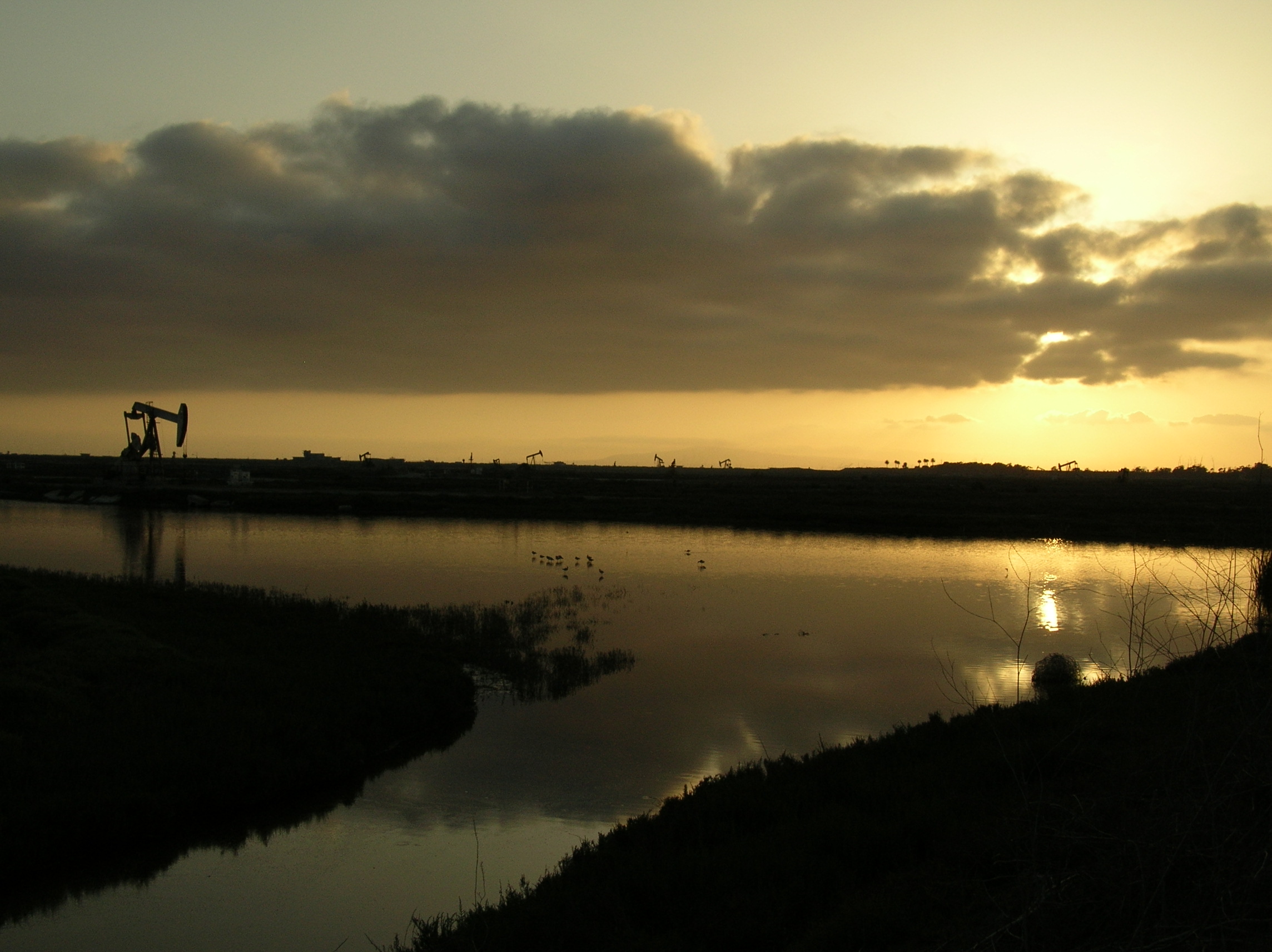
Photo courtesy of Wikimedia
Hbdragon88 under CC-BY-SA license
There are about 3 miles of good, accessible trails in this wetlands site. Recently set aside from development, this area had been threatened with the building of more tract housing. It is still adjacent to oil fields and part of the mesa-top area is still slated for development.
All that aside, however, it's still a great place to go for a walk. It's just across Pacific Coast Highway from one of the area's most popular beaches, Bolsa Chica State Beach. This is birdwatcher's paradise and you get a good close up view of the birds, the fish, and other wildlife in the area. The trails range from paved, to boardwalk, to packed dirt but all will accomodate wheelchairs. Accessible, portable restrooms are located in the small parking lots.
Take the 405 freeway south to Orange County to the Golden West St. exit. Head south, towards the beach, to Pacific Coast Highway. Turn left on PCH. The reserve will be on your right. Look for the small parking lot. If full, continue on PCH to Warner Ave. and turn right. There is another small lot there.

This suburban trail is just a little over 2 miles long on a abandoned railroad right-of-way. This is where the famous red car trolleys of the Pacific Electric Railroad used to roll. The trail is paved for its entire length and crosses 4 streets along the way. There are 2 water fountains along the route plus more at the trail's terminus in Royal Oaks Park.
Along the trail you will see many oak trees (it parallels Royal Oaks Drive) plus plantings of various other species of trees the city has done to create a more "forested" atmosphere.
There are also a lot of flowers at any given time, plus a few fruit trees along the way. The trail marks the dividing line between Duarte and its neighboring city Bradbury. On the Bradbury side of the trail are many horse ranches including an English riding academy where jumping is taught (you'll also share the trail with some of these horses). You'll also see many birds and squirrels.
The trail terminates at Royal Oaks Park where there are tennis courts, basketball courts, a playground and picnic areas.
To get to the Duarte Recreation Trail, take the 210 freeway east from Pasadena to Buena Vista Ave. in Duarte. Turn left to Royal Oaks Drive and turn right. The trail starts at the corner of Buena Vista and Royal Oaks Drive. There is free, 3 hour parking available along Royal Oaks Drive.

EATON CANYON PARK, PASADENA
Up in Pasadena, just above where the Rose Parade ends, is this park. A caveat here, this is only a dry season trail. When the rains start and through spring into summer, there is a creek flowing where you'd have to ford through the shallow water to continue. Unless you've got a waterproof power chair or have extraordinary strength, when it's flowing you'll be limited to the quarter mile or so of trail network from the parking lot.
When it's dry, however, you've got miles of trails to explore. Most of the trail is smooth and fairly wide, although there are a few spots where you'll have to pick you way through rocks embedded in the ground.

It certainly helps to go with a partner who can help you out in these areas.
It's typical Southern California brush and foothill forest and you'll see birds, reptiles and may even a snake or some deer.
We went looking for remnants of the Mt. Lowe Railroad, a trolley system that took visitor's up the mountain to a grand hotel and tavern. All of it is long gone now, so you'd have to know exactly where to look and not expect to see much except to know this magnificent railway attraction once stood here. Groups of trees up on the ridges mark where some of it once stood.

Handicap parking and restrooms are available at the trailhead and the visitor's center. Click on the link above for directions. You can also take the Metro Gold Line light rail line to Sierra Madre Villa Station and transfer to the Metro 264 bus, northbound, to the park entrance. This adds about a quarter mile each way to your hike.
LEGG LAKE/WHITTIER NARROWS, SOUTH EL MONTE
This county-run regional park has many miles of good, accessible trails within its borders. At Legg Lake itself, more park than any kind of wilderness experience, you can cruise over 3 miles of lakeside trails. You can even stop to drop a line in this trout stocked lake. There are also areas to watch the radio controlled power boats race and feed the many ducks & geese.
Outside of the park, you can get on some more wild trails that lead over to the nearby San Gabriel and Rio Hondo Rivers and access the San Gabriel River and LARIO paved bike paths. The bike paths are accessible adjacent to this area.
The San Gabriel River side of the area is a wildlife sanctuary so it's easy to see rabbits, squirrels, coyotes, lizards, snakes, birds, and more.
Take the 60 (Pomona) freeway east from L.A. to the Santa Anita exit and turn right. The parking lot will be on your immediate right. There is a parking fee on weekends & holidays. To get to the more "wilderness" feeling trail, continue on Santa Anita to Durfee Ave. and turn right. At the curve just ahead, before you get to Rosemead Bl., is an access gate to the trail that wheelchair users can negotiate. You can park there or back at Legg Lake, across the street and one block away. There is also a nature center on Durfee Ave., back past Santa Anita Ave. and before you reach Peck Rd. on the right that has parking and a paved 1/2 mile interpretive nature trail. Handicapped parking & restrooms are located throughout Legg Lake park and the nature center. No facilities are on the more "wild" trails.

Ojai-Ventura Trail (added March 2011) - This 11 mile paved trail runs from the beach in Ventura to Ojai up in the hills. Starting at the sandy beaches of the pacific, there's then a mile or so of oil fields before you get to the really scenic part of the trail in the oak forests of the foothills. It's a 750 foot elevation gain from Ventura to Ojai, which makes it a little less that 70 feet per mile. You can also take the SCAT #16 bus up to the top end of the trail and roll down from there...it's all downhill.
The trail starts at the north end of Ventura, where the Ventura River meets the ocean, on top of the south levee of the river. It ends at the western edge of Ojai at the junction of highways 33 and 150.
RIVERSIDE, MOUNT RUBIDOUX

Go ahead and add a peak to your wheelchair hiking collection. This 1,329 foot summit, just a mile west of downtown Riverside, used to be open to autos until 1992. That means there are two, excellent smooth paved trails to the top that are perfectly suited to wheelchairs.
The loop is three miles. The north road is a little less steep so go up that way and come down the south road. Beautifully maintained with great scenery on clear days of Riverside to the east and the Santa Ana River and Jurupa Valley to the west.
For more, see our report on Riverside at this link.
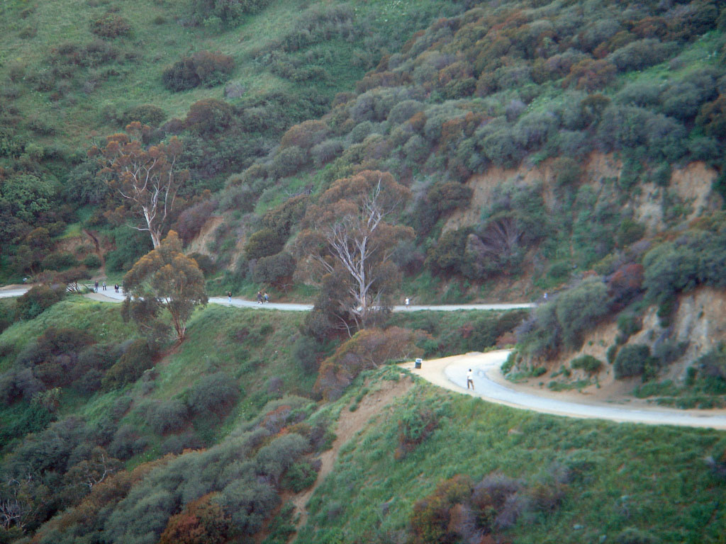
Photo courtesy of Wikimedia
Alain Demour/Scewing under CC-BY-SA license
RUNYON CANYON, HOLLYWOOD
Here's an urban hike for you city dwellers and Hollywood tourists. Just above the fray that is Hollywood Bl. is this beautiful, wild area nestled into the Hollwood Hills. Two miles of wheelable trails take you up, into, and around this canyon park which stretches from Hollywood at its base to Mulholland Drive at the top.
Power chairs will have no problems on any trails. Manual chairs will do well on the trail in the canyon bottom and stronger users will be able to negotiate the steeper trails that wind up into the hillsides (or bring along a pusher).
The bottom of the canyon is lined with trees, including many palms, and the hillsides are typical Southern California brush. Going up on the hillside will reward you with a spectacular view of Hollywood, the Wilshire District, and the skyscrapers of downtown L.A.
There are only two problems here. First, many locals bring their dogs to walk here. While there are many signs and plastic bag dispensers, many owners do not pick up as they should so the areas near the entrance have a distinctly less than pleasing aroma. Second, parking is very limited along the streets near the two entrances. You can avoid the parking problems by taking MTA's Line 1 bus and walking (uphill) 2 blocks from Hollywood Bl.
The park is located two blocks north of Hollywood Bl. (or one block north of Franklin) just west of La Brea Ave. The two entrances are on north ends of Vista Street and Fuller Ave. While both entrances can accommodate wheelchairs the entrance on Fuller is much friendlier and provides instant access to the canyon bottom. All trails are smooth enough for chairs and connect with each other.

TRAIL OF 100 GIANTS, SEQUOIA NATIONAL FOREST
This is a magical trail which winds around-and sometimes through-some ancient Giant Sequoia trees. This trail is well off the beaten path. It's not in Sequoia National Park, it's in the national forest that lies south of that tourist-magnet. It'll take you more than an hour to drive here from the nearest town. It's a challenging drive.
This is not meant to put you off from coming here; merely to explain why once you're here you'll see very few other people.
While not officially a wheelchair accessible trail, nonetheless the trail is graded and hills are moderately ramped specifically to provide wheelers access. The trail itself is a 1 1/2 mile loop through a grove of Giant Sequoias. These trees are absolutely unbelievable. Well meaning people of the 19th century understandably thought explorers were handing them a tall tale when they heard of these 300 foot giants with trunk diameters of 30 feet and more. They're real, though, and if you've never seen one you owe it to yourself to go.
On the trail you'll see dozens of these giants...including one you can wheel into (see picture)...and cross many streams. It's very quiet here and many animals and birds live in the area.
The easiest way to get here is via Kernville in the southern end of the Sierras. From Kernville, take the very scenic state mountain highway 99 north to state mountain highway 60 and turn right (north) and go to mile marker 13. Here you should see a sign for the trail and a parking lot on the right side of the road. There are no dedicated handicapped spots but there's plenty of room. There are accessible toilets here also. The actual trail is across highway 140 from the lot.
- Darryl
You should check out the John Dillon Park in Long Lake, NY in the Adirondack Mountains, which is a fully accessible wilderness park.
ReplyDeleteAwesome. Goos point for writting about this.
ReplyDeleteThe good thing about the USA is that the country and outskirt roads are just wonderful for bike riding. Over here in Asia, it can be a little dangerous in terms of the crazy traffic. Well, I do hope you try bike riding here in Southeast Asia. Borneo is one of the popular places too.
ReplyDeleteThe link for AZUSA CANYON, WEST FORK OF THE SAN GABRIEL RIVER
ReplyDeleteis not working.
http://www.nearfield.com/~dan/sports/bike/mountain/sgwf/index.htm
Thanks, Ayman. Should be fixed now.
ReplyDeleteOf course, what a magnificent blog and informative posts, I will bookmark your site.Best Regards!
ReplyDeleteThank you for posting this wonderful list ! I've always wanted to go on a Nature hike and take photos of wildlife I encounter as Amateur Photography is one of my favorite hobbies. But I was told alot of the nature trails aren't wheelchair accessible. I use a wheelchair when outdoors so it saddened me to know none are accessible to me. Then I came across your site via google search. I am hoping to visit some of these trails with my husband in the next coming weekends. Thank you again for posting this !!
ReplyDeleteThank you for posting this wonderful list ! I've always wanted to go on a Nature hike and take photos of wildlife I encounter as Amateur Photography is one of my favorite hobbies. But I was told alot of the nature trails aren't wheelchair accessible. I use a wheelchair when outdoors so it saddened me to know none are accessible to me. Then I came across your site via google search. I am hoping to visit some of these trails with my husband in the next coming weekends. Thank you again for posting this !!
ReplyDeleteHey, very nice site. I came across this on Google, and I am stoked that I did. I will definitely be coming back here more often. Wish I could add to the conversation and bring a bit more to the table, but am just taking in as much info as I can at the moment.
ReplyDeleteThanks for sharing.
Reclining wheelchair
Keep Posting:)
Hi. I am so happy I came across your site. I am always looking for outdoor activities to do with my boyfriend who uses a manual wheelchair.
DeleteThanks so much for your site! I am a leader for my kids' Cub Scout pack and my 4 year old in a wheelchair is excited to start in the fall. In the past we've done some hiking which would not be accessible for him, so I've been trying to scope out accessible trails so that he can participate once he starts. We live in the San Gabriel Valley so these trails listed are all close to us! Thank you soon much!
ReplyDeleteThanks so much for your posts! My 4 year old son is in a wheelchair and will be starting cub scouts in the fall. As one of the leaders in the Pack, I've been trying to scope out accessible trails so that he can participate when he joins. In the past we've done Eaton Canyon hikes which wouldn't be accessible for him. We live in the San Gabriel Valley so these trails you list are all close to us. Thanks again!
ReplyDeleteHi Darryl,
ReplyDeleteA hiking friend recently broke her leg and I found this blog post very helpful for finding a trail that I could take her to while she is recovering in her wheelchair. I chose Dalton Creek due to the proximity of where we lived. The trail round trip was about 2 miles, but the 1 mile uphill is quite brutal with a manual wheelchair. Total elevation gained was 394 ft. I pushed her and had to take multiple breaks - but it was well worth it to be outdoors on a "real" trail instead of a park. It took us about 1 hour total. I found your instructions very clear and helpful. Thank you! Cathy
Thank you, Cathy. Glad you had a good hike. For easier trails, the Duarte Recreation Trail, Bolsa Chica, and the Legg Lake/Whittier Narrows trails are basically flat. The East Fork of the San Gabriel River trail gains 600 feet over 6 miles, roughly 100 feet per mile, and is not too bad plus it's downhill all the way back to the parking lot. It's also a very beautiful and paved trail once you get about a quarter mile in from the entrance where most of the public won't go beyond.
Delete