Sunday, October 2, 2011

The Cocktail Hour - Belgian Beer Festival


The World on Wheels crew gets out of the patio this week and goes on location to Lucky Baldwin's Pub in Sierra Madre, California just east of Pasadena.  There's also a Lucky Baldwin's in Old Town Pasadena. It's the 11th annual Belgian Beer Festival where, in their words, the largest selection of Belgian beers in the world are served on tap.


Maybe, I don't know. But there are 46 taps and 29 of them (on this day) are dedicated to the Belgian brew. The kegs are rotated, so what's on tap today may not be what's available on Monday. I do know that they will be serving around 60 Belgians on tap during the festival, which happens in February and again in the summer.


The way it works is this... 6 oz tastes are $4 with an extra dollar tagged on for the ultra-premium brews. Pints are $7-9 dollars. You can get a package with a souvenir glass and t-shirt for $20. The glass comes filled with whatever brew you want. Come in anytime during the next year, and get a dollar off of your beer. It's not as good as it sounds because the glass is only 12 oz. and they usually sell pints. You can see the glasses at the end of part 2 of the video.

I'd put the entire video up at once, but YouTube only allows 10 minutes at
a time, so I have to break it into two parts.


Here is part 1 of the video...


and here is the conclusion...


Enjoy!

-Darryl


Thursday, August 4, 2011

The World on Wheels - VIDEO CHANNEL


Don't forget, this is a multimedia blog.  We currently have over 40 100(!) videos available covering trips from the United States and Europe, plus our popular Cocktail Hour videos.


To celebrate our 100th video, we've uploaded a new trailer for the video page.


Watch the trailer below for a sample and then click the link below that to see the entire collection from our video channel.

-Darryl

Monday, June 27, 2011

CLASSIC TRIP - Campo, California 1998

Back in 1998, we took this train excursion along the border in San Diego County.  A bit has changed since then, but you can still go down there and ride the rails.

A Trip Back in Time
...an accessible & affordable adventure to the borderlands of California.

Where is it?

Campo, California and Tecate, Baja California, Mexico

Campo is a tiny speck of a town along the U.S. - Mexico border located halfway between Tijuana and Mexicali (or San Diego and El Centro on the U.S. side) across the border from Tecate, Mexico. The challenge here was to make a nice weekend in Campo instead of it being a side trip from San Diego.

Campo is located 9 miles northeast of Tecate, Mexico on the U.S. side of the border. From L.A. we took the 10 (San Bernadino) Freeway east to Interstate 15, then south to Interstate 8 in San Diego, then east on the 8 to Buckman Springs Road (about 35 miles). Then south on Buckman Springs Road to Highway 94 in Campo. Right (west) on 94 to Forest Gate Road. The entire drive took just over 3 hours. From San Diego, count on about an hour.

Preparing for this trip was difficult. There are no accomodations in Campo - period! There is some camping nearby, but roughing it was not what we had in mind with our son Tim & his 200 pound power wheelchair. We were also taking along some guests and needed to have room for them too.

Calling ahead to Campo produced no good information on where to stay nearby. We had considered staying in Tecate but could not get reliable information on accomodations there outside of a very pricey spa. A bed & breakfast in nearby Dulzura offered some intriguing possibilities but, alas, they were booked for the weekend.

Two others within a 20 mile radius looked interesting, Jacumba Hot Springs and Stallion Oaks Ranch. Both had hot tubs to soak off the desert dust, and both were reasonably priced. A call to Jacumba Hot Springs revealed that although they were only about 20 miles away, the drive to Campo would take about an hour on the narrow, winding roads in the area. Stallion Oaks also offered a 2 bedroom cabin we could stay in for a little less than 2 motel rooms at the hot springs. Stallion Oaks got the nod.

Stallion Oaks Ranch is in Descanso. From Campo, backtrack to Interstate 8, head west back toward San Diego and exit on Highway 79. Go north one mile to Riverside Dr. and turn left. Turn left again at Viejas Grade and make an immediate right on Oak Grove. Turn right again on Boulder Creek Road. Stallion Oaks is at 10950 Boulder Creek Road. (619) 445-0271.

(UPDATE 2010: Much of Stallion Oaks burned in a 2003 fire, it is now the Unity Center Retreat Center and a subsequent stay at Jacumba Hot Springs was horrible...can't recommend)

To Tecate, the easiest way we found is to go back to Campo and head west on Highway 94. Turn left (south) on Highway 188. The International Border will be 2 miles straight ahead.

The trip:

Bright and early on a beautiful May Saturday, we set out on our adventure. We had picked this particular weekend to go because the San Diego Railroad Museum was scheduled to be using their restored steam engine on their excursions out of their historic Campo depot. Most weekends they use a diesel engine (you can check the schedule out at their web page at www.sdrm.org or by calling toll-free at 888-228-9246).

First stop was for some breakfast. Today, we were going to the great Homestyle Cafe in Guasti (exit Archibald Ave. off of the 10 freeway in Ontario. Turn right (south) and turn left into Guasti...follow the signs).

If you're hungry for breakfast...really hungry...this is the place for you. Mammoth portions of great homestyle cooking are in store for you here. One meal is plenty for two people. We had eggs & ham, eggs & sausage, and Tim had a pancake. All except Tim's meal came with biscuits & gravy and potatoes. Tim's pancake was 12" across and an inch thick.

We saw plenty of people here ordering short stacks only to be amazed at the 3 square feet of pancake they had ordered. Plenty of take out boxes were in use here.

This drive is particulary scenic...once you get on Interstate 15. First, you drive past all the dairy farms of Chino & Norco (scenic but also aromatic), then through the rolling hills of Temescal Canyon, into Lake Elsinore. From there, you come upon Southern California's premiere wine country, Temecula.

We stopped at Temecula to pick up some sandwiches at the local Togo's Eatery to take with us for later. Togo's makes great sandwiches and are very reasonably priced. Togo's in Temecula is located at 28150 Front St. at the Rancho California exit off of Interstate 15.

The plan was to eat a picnic at the depot in Campo, but we were all still so full from that huge breakfast that we skipped lunch and saved our sandwiches for dinner.

For being on the edge of one of the hottest deserts in the nation, Campo is amazingly green. This is due to the extremely high water table in the area. The Campo depot itself sits on the south side of the lush, green meadow that is visible throughout the town.
We arrived at the Campo depot of the San Diego Railroad Museum at 1:00pm, 90 minutes before the next train was scheduled to depart. One of the museum's docents was just about to start a walking tour, so we grabbed some cold sodas out of the ice chest & tagged along.

On the walking tour we saw some great old railroad equipment & rolling stock all in various stages of restoration. Pullman cars, old San Francisco streetcars, cabooses, diesel & steam locomotives and more.

We learned that this particular railroad was built around 1915. In fact, you can see that date stamped into the rails and many of the bridges nearby.

Next door was Fort Leggett, the last mounted cavalry post in the U.S. At the start of World War II, this base housed 5,000 men and 10,000 horses. As the cavalry was motorized, the base became a hospital unit and a POW camp for Italian and German prisoners. Many of the POW's contributed to the construction of nearby buildings and roads.
After the tour, we headed back to the depot area to await the train. The train consisted of the antique steam locomotive, 3 restored passenger cars, and one restored baggage car that served as an on-board snack bar as well as housing the restroom facilities. The doors on the baggage car are left open to provide a scenic spot to stand and get some fresh air as you travel.

The star attractions here, of course, are the trains. The museum has plenty of rolling stock on display and in use for their excursions. We came today to take to regular weekend excursion offered by the museum to nearby Miller Creek. Today though, we would be pulled by vintage steam power as opposed to the old diesel that usually runs. (Note: The museum also runs special occasional trips the other way into Tecate, Mexico combined with wine or brewery tour and also sponsors special one-of-a-kind trips such as to the Copper Canyon or recently held Comet Trains at night to watch the Hale-Bopp Comet. Visit their web site or call them for more information on these special trips.)

Kids of all ages just seem to love trains. Especially old ones (trains and kids). The ride lasts about 90 minutes and goes through some absolutely gorgeous scenery. Throughout the ride you see exactly one road and only sporadically at that.

You end up in a area that has seen absolutely no development in the last 100 years and looks exactly as it did when bandits, cowboys, & Indians freely roamed the area. In fact, not much has changed...this area is still heavily used by smugglers to bring undocumented aliens and contraband into the states. The U.S. Border Patrol is a much seen presence in the area trying to combat this. Today we see no criminal elements at play but do not have to try very hard to imagine why such a land has attracted outlaws throughout history.
Museum docents provide an excellent commentary on the area, it's history, and the train's history as the journey commences. Noticing the frequent whistling of the train, they remind you that you too would be pulling that whistle every chance you got if you were doing it for fun.

That's because the engineers, the conductors, the brakemen...in fact everybody working here...are unpaid volunteers doing this just for fun. You can even sign up to ride in the cab and take a few minutes at the controls yourself.

With the trip over we headed back the way we came to find our cabin at Stallion Oaks in nearby Descanso. Fortunately, the folks at Stallion Oaks had faxed us the directions before we left or we would have really been lost.

Stallion Oaks is located in the foothills that lead up to Julian. It's way off the main highway set on 200 private acres of oak forest and meadows. We rented a 2 bedroom cabin that also had a living room, dining room, kitchen and fireplace. Very clean and nicely decorated. The price for all this? $99 per night, split between us and our guests that came to $49.50 for each party.

There are also motel rooms here that start at around $50 per night and luxury "romance" cabins that have their own spa for around $130 per night. There is also a campground with everything from tent spaces to full-hookup RV spaces.

Facilities here include a pool, a spa, a fishing lake, covered bridge, carriage rides, general store, and more. We settled in for a nice long soak in the spa that really cut the day's road dust off of us. Afterwards, when Tim found that the TV would not get any stations here, we went for a moonlight walk in the nearby meadow. We only got a couple of mosquito bites, but they are out there.

In the morning we hiked to the lake which is about a mile from our cabin. It was then that we noticed all the poison oak lining the road. Luckily, we must have missed touching any the night before because no one got a rash. We got to the lake, which was a little low at the time. It was still a nice walk, including a covered bridge, although it was a bit buggy with flies & gnats.

After the hike, we packed up and headed down to Tecate where we planned to eat breakfast.

Even though we had a map, we made a wrong turn and ended up going about 40 miles out of our way. The backroads down here are very easy to get lost on! It's a very scenic area though so it was still a nice drive.

We crossed the border at 11:30am and, after a quick inspection by the Mexican border officials, we were on our way. It's a grand total of 2 blocks from the border to downtown Tecate where we parked at the town plaza and set out to find some food. You might even want to park on the U.S. side of the border and walk in (U.S. auto insurance is void in Mexico) but beware it’s all uphill coming back.

We quickly found Cafe Los Pinos on the east edge of the plaza and ate there. The meal for the 3 of us consisted of quesadillas, 2 bowls of menudo, and four tacos accompanied by refried beans and soda. Great food and only $11.00 for everything.

After that, it was off for an afternoon of shopping where my wife picked up some pottery at great prices (watch out though, because there are some reasonable pottery stores and some very unreasonable ones...shop around and bargain).

Tecate is unlike any other Mexican border town I've seen in that it is more like a small Mexican town and unlike the anything goes atmosphere you find in other border towns like Tijuana. It's quiet, pretty, and peaceful. Be aware here that the border closes at 8:00pm...if you're in Tecate after that, you either spend the night or drive to Tijuana or Mexicali to get home.

Tecate is also the home of Cervecería Cuauhtémoc Moctezuma, makers of town's namesake beer. Brewery tours are available, along with free samples in their beer garden, if you call in advance....

After our afternoon in Tecate, we headed back to the U.S. There was a total of 4 cars in line at the border crossing making for a very quick crossing. As you might know, this compares with a few hours that a Tijuana border crossing can take on a Sunday afternoon.

After getting lost in the morning, we decided our best course of action was to head back toward Campo and travel back out through there. From here it was a nice, uneventful ride back to L.A. and the reality of our jobs. All-in-all, this was a very pleasant overnighter that didn't even come close to breaking the budget.


-Darryl
Copyright 1998 - Darryl Musick

Friday, June 10, 2011

COLORADO INDEX - 2011


Here are the links to all our content for our Salute to Colorado:

Denver Part 1 - Where we arrive, take in a game at Coors Field, and have a wonderful dinner at 
the Wynkoop Brewery.


Denver Part 2 - Downtown Denver, LoDo, 16 Street Mall, and the Denver Zoo


Denver Part 3 - Red Rocks Park and Amphitheater


Colorado Springs - Garden of the Gods, Seven Falls, Pike's Peak, and Cowboy Steak Dinner.


Denver Pub Crawl Part 1


Denver Pub Crawl Part 2


Fields of Dreams - Coors Field, home of the Rockies


Denver Transit Report


-Darryl

Monday, May 23, 2011

LOS ANGELES: More Walking in L.A...Fountains and more.

Please join me for another edition of Walking in L.A...

Let's start off with this military flyover as we exit the train at Union Station.  That building is the headquarters of the Metropolitan Water District.

Here's a closer look.

Walking up Main Street from the station, we go past the United States District Courthouse, solidly built in 1937 as a WPA project during the Great Depression.

Turning up Temple, we come to this little art installation/fountain in from of the Hall of Records.  It's one of my favorite fountains.  It's hard to see, but that represents a map of the southern half of California and all the sources of Los Angeles' water.  A trickle runs down each river and aqueduct ending up in the pond at the bottom that represents the city.

Moving up the street we come to the Music Center, home of the the Ahmanson Theater and the Dorothy Chandler Pavilion.  This ever-changing fountain cools visitors off in its plaza.

Around the corner on First Street, next to the Stanley Mosk Courthouse is this nice little fountain.

Don't you want to just jump in?  Go ahead, I don't think anyone would mind...

Across the street is this temporary pond, where the state government building used to be.  Now, it's a giant hole in the ground, owned by the federal government which plans to build a new courthouse there someday.  For the time being, it collects rainwater and runoff.

We'll finish up this walk by going south on Olive to Pershing Square where you can get this great view of Bunker Hill's skyscrapers.  You'll need to go on Wednesdays, though, if you want to go to this nice little farmer's market.

-Darryl
Copyright 2011 - Darryl Musick
All Rights Reserved

Monday, May 2, 2011

CLASSIC TRIP - New York 1999, Part 1

UPDATE: 5-2-11, I had other plans for articles this week, but they'll keep.  It seems like a good week to celebrate the great city of New York instead.


Let's go back to 1999 to our first trip to the Big Apple.  Standard disclaimer, prices, events, and other items are accurate for 1999-things have changed...

In our travels around the country, one place intimidated me...New York. I heard all the horror stories about the crime, the filth, rude people, crowds, traffic, etc. My old boss (from Brooklyn) told me about how he got a flat tire and while he was changing it, someone started to steal the rear tire. You see movies like Taxi Driver and Mean Streets and have to wonder.

My son, on the other hand, had no such emotional baggage. He always wanted to see this city. He wanted to go up to the top of the Empire State Building, the Statue of Liberty, Times Square, and perhaps most of all to ride the Cyclone in Coney Island.

A couple of years ago, we decided to take a fall trip to the northeast corner of the country to see the fall colors. Since New York was only a few hours to the south, we decided to spend a couple of days there just to see what it was like, give Tim his time there, and continue on our way.

The short story? My illusions of the city were shattered. None of my preconceptions held any water at all. We loved it and made it a point to come back in the spring for a longer trip. Now the long story...

Our flight into Manchester, New Hampshire arrived two hours late. A rather long drive finally deposits us at the Susse Grand Chalet in Stamford, Connecticut at four o’clock in the morning. Dead tired, we happily climb into bed.

(to see what I think of Susse Chalet, my review is at http://www.epinions.com/content_42139750020 )
We wake up in time to catch an 11:00 Metro North train into Grand Central Station. 35 minutes later, we exit into Grand Central’s beautiful lobby. Being our first time in New York, we can’t help ourselves and quicky run out the door for our first glimpse of Manhattan’s famous skyline. A sense of vertigo envelops us...we have no idea where we are...and we see the familiar sight of the Chrysler building and the Met Life building.

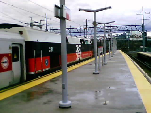
It’s time to head back in to continue on our way to Brooklyn and Coney Island. We set ourselves up for quite a challenge. The MTA’s web site says that 33 of the city’s subway stations are accessible. Armed with our $4 fun passes (a one day pass that gives you unlimited rides on the city’s buses and subways), we feel that nothing can stand in our way.

Plotting this out on the excellent, free subway map we got at the information booth, we see that the B line (which goes to Coney Island) stops at the Lexington Ave. station near Central Park and also has an access symbol on it. The 4�5�6 lines go from Grand Central to the Lexington Ave. station. It’s decided to take the 4 up to Lexington and then switch over to the B.

Two things come up wrong with this plan. First is almost immediate and has to do with looking at our map a little closer. Although the Lexington Ave. station is accessible for the B line, the 4�5�6 line part of the station isn’t. Whoops. We cheat a little and take the escalator up to the B line station.

Once on the B train, problem number two crops up, although compared to the first problem is relatively minor. The B train turns out to be a local, stopping at every station along the way. It will take forever to reach Coney Island. On the other hand, we occasionally see a D train, the Coney Island express, stopping across the platform from us. Quickly, we decide to transfer at the West 4th Street station and continue on.
Eventually, we get to Coney after a scenic ride through Brooklyn (the D line goes elevated here). Brooklyn looks a lot like East L.A. The Coney Island station was built in 1919 and is certainly showing its age. It’s dark, dank, even a bit scary looking inside. But it has that very welcome accessory...an elevator.

We emerge onto the corner of Stillwell and Surf, directly across from our lunch destination, Nathan’s. Nathan’s has been here for eons selling their world famous hot dogs. We grab a few and are not disappointed. They are very tasty. This Nathan’s is also very popular for its seafood. Some of the locals there swore by the fried clams. This bit of legendary New York cuisine sets us back only $10 for the three of us.
Unfortunately, Coney Island’s famous amusement parks are closed for the season. Tim & I were hoping for a ride on Cyclone, revered as one of the world’s top coasters. No ride today, only pictures.
Time to take the D back to Manhattan to the Herald Square station, which is accessible (but the elevators are very hard to find and no one there seems to know where they are). A short walk over to Grand Central and we hop back on the 4 train southbound to the Brooklyn Bridge. This time access works as planned and the elevator deposits us directly across from the walkway over the bridge. Here we get an unforgettable walk with great views over this old, historic span.

The bridge is clothed in deepening darkness. It’s to return to Grand Central and catch a Connecticut bound train home.

Scroll down below for Part 2...
 
-Darryl
Copyright 1999 - Darryl Musick

CLASSIC TRIP - New York 1999, Part 2


Back in 1999, we visited New York for the first time.  The first day, we took the subway to Coney Island.  Now, we head back to see some sights in Manhattan.  Back in the WayBack Machine we go...

Today is our Manhattan day. Maybe we shoulda done it yesterday too, but we just had to see Coney Island.


We retrace our steps to the Brooklyn Bridge station and start walking towards the Battery. It’s Columbus Day and we stumble onto a sidewalk festival around Bowling Green Park. The three of us eat a lot of strange and colorful food and wash it down with some beer and soda.
Arriving at Battery Park, we head over to the water to see the Statue of Liberty. It’s amazingly small. Much smaller than we were prepared for, but still, it’s one of those things you want to see. It reminds me of how everybody has to see Hollywood when they get to my hometown, only to be amazed at how dirty, depressing, and disgusting it is. At least the statue is just small...none of the other bad things can be said of it.

The wait for the ferry is several hours. We already know that the statue itself is not accessible, so we content ourselves by gazing at it from the shore. We do want to get a closer look, however, and NYC’s public transit system again comes to the rescue.

The big yellow boats of the Staten Island Ferry will take you right by Liberty Island on a scenic, free, and accessible cruise over the bay. Even close up, the statue still looks small. The view of Manhattan from the fantail is what postcards are made of though.
Back at the Battery, we walk a few blocks up to the World Trade Center. New York’s tallest buildings are actually a big complex of buildings atop a mall and a sprawling subway station. I am shocked and deeply saddened, today, that a few lunatics could erase it off of the landscape.

The map here shows several lines are accessible. The station master told us only the E line was. Lacking any other obvious signs of access, we boarded the E line to Penn Station, which our map said was accessible.

Penn Station, at least on the E line, turned out to have stairs...no elevator. Doing it over, we would take the E a little bit farther to the Port Authority station where there is an elevator. We work Tim up the stairs in relays with him and his chair and proceed down 34th Street to our next destination, the Empire State Building.

Along the way, hungry for lunch, we decide to try some New York pizza. We find a little hole-in-the-wall called Spinelli’s and have a few slices. Yes, New York pizza is delicious and, yes, you need to fold it to eat it right.

We find the usual handicapped entrance to the Empire State Building on 34th is closed but a maintenance worker quickly directs us around the corner to the entrance on 5th Ave. Although not signed as such, an accessible entrance does indeed reside there between two revolving doors.

A guard directs us to an elevator to go to the basement where the ticket counter is. Like Disneyland, you skip the line here if you are disabled and go right up to the counter to purchase tickets for the observation deck. Adults are $6, kids $3, and handicapped are comped.

Next, an ear popping ride up to the 80th floor followed by a another quick ride to the 86th floor deck. An additional elevator goes up to the 102nd floor but was closed this day. The deck we were on is the one you see in “Sleepless in Seattle”.
The view from here is amazing. On a clear day, as ours was, 50 mile views are possible. Even a jaded kid like Tim was impressed by it. After the obligatory visit to the gift shop for miniature versions of the building, we head uptown (by foot) towards Central Park.

Along the way, we swung through Rockefeller Center to see the ice rink and the Today set and then up 5th Avenue by Tiffany’s to the park.

We just did a quick loop through the southern end by Tavern on the Green and Wollman Rink to see what it was like. As it was getting dark, we headed south to Times Square.
Here the lights knock our socks off and the energy of the place seeps in. The the vibrancy of New York is on full display. We also find the only clean public restrooms we saw in the city at the Times Square Starbucks.

We’re only there for the facilities and end up having some drinks, music, and a marvelous time at the accessible Times Square Brewery.

At the end of the evening, it’s a short walk east to Grand Central Station for our train home.

Back in 2011 - This was, of course, only our first trip to New York.  After having had a taste, we'd return again and again.  Those reports will be coming up on future episodes.  

-Darryl

Friday, March 25, 2011

BootsnAll: Nine of the Most Wheelchair-Friendly Cities to Visit Now

I just had this article of mine published at BootsnAll.com ...


"Most travelers only worry about getting a decent hotel, finding a place to eat, and maybe getting a deal on a rental car at their destination.  Wheelchair users must also worry about encountering stairways, narrow doors, accessible bathrooms, and transportation. In some places it can be near impossible for a wheelchair user to find an affordable accessible hotel, let alone navigate the city streets and public transport. In others, it’s a lot easier.

Knowledge is power, so with that in mind, here are some of the most wheelchair-friendly cities for travelers..."

To read the rest of the article, go to BootsnAll.com , Nine of the Most Wheelchair-Friendly Cities to Visit Now.

Thanks,

-Darryl

WALKING IN L.A. - More wandering...

Another urban hike through downtown Los Angeles to see what I can find...


Michael Jackson's doctor, Conrad Murray, is on trial for manslaughter.  Before the actual trial was a pre-trial hearing that lasted for weeks.  Here are all of the news vans parked on the sidewalk covering the action.  As a bonus, that parking lot on the other side of the green fence was "Camp OJ," where the news media had a temporary facility to cover the O.J. Simpson trial.  Both trials are/were held in the building in the distance, across the street.

Soap opera fans may recognize that building way in the distance as "General Hospital," a name we also used to call it many years ago.  The real name is USC-Los Angeles County Medical Center.  The old building is no longer used, a new replacement hospital was build next door.

A view looking up the Hollywood Freeway with the cathedral on the left and the new high school on the right.

This is a monument to Fort Moore which stood on this hill back in the early days of the city's history.  When I was a kid, there was a waterfall pouring over that wall.  The water hasn't flowed for at least 30 years now.

When the film industry is in high gear, these yellow signs are a familiar sight.  They point out the parking area that the crews are supposed to use for the shoots.  The one on top is for the show "Common Law." The other two must be for commercials or pilots that haven't been picked up yet.

If you'd like to see more, check out our first Walking in L.A. post.  If all this walking has made you hungry, check out our Three Meals a Day...All Across L.A. video report.

-Darryl
Copyright 2011 - Darryl Musick
All Rights Reserved

Monday, February 28, 2011

Another Accessible Travel Site: Abilitytrip.com

Run by husband and wife, Darren and Faith Brehm, I'd like to welcome Abilitytrip.com to our list of Favorite Links. Abilitytrip.com is another resource for your accessible trip planning. With reports from destinations around the globe, you can use it to know before you go whether it will be accessible enough for you.

Also handy are the trip tools, like a packing checklist and travel documentation template to help you make sure you have everything when you go.

I plan on using this site to help with upcoming trips and think it'd be a great resource for all my visitors to check out.  Find their link in the blogroll, over in the left column, or click the link below and add to your favorites.

abilitytrip.com